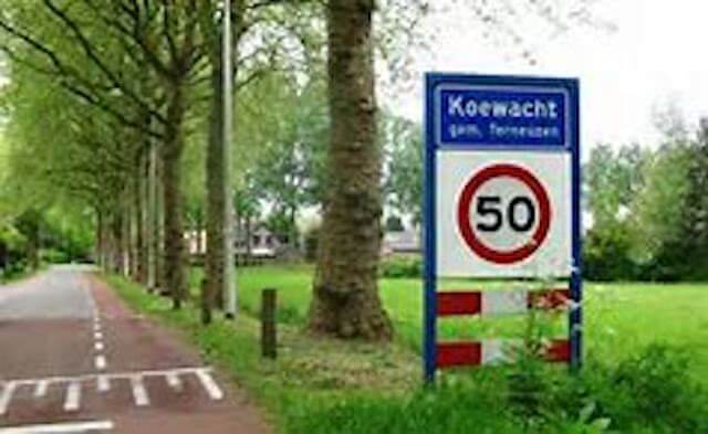
With this walk we follow the traces of the past. Wars have caused Koewacht a lot of misery for centuries, but also beautiful places. Which you can now happily fully enjoy.
Distance: 4.3 km.
Time: 1h15.
Grade: Easy.
Type: Circular.
Gps Track: Yes.
Route description: Yes.
Wheelchair: Not suitable.
Dog: Allowed.
Height gain: Flat.
Trail: 25% unpaved.
Marking: Walking nodes.
Hiking shoes recommended.
Advertisement.
Battlefield in the Delta.
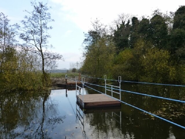
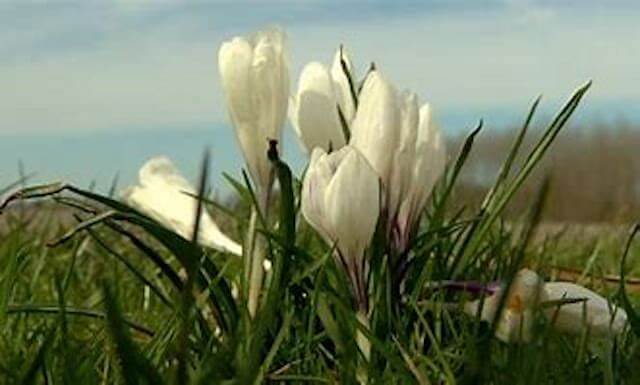
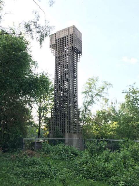
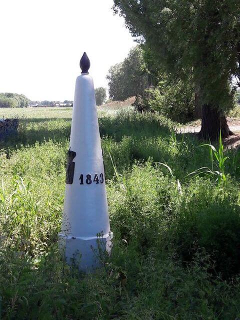
The walk in Koewacht is actually an old one. It was created a few years ago, thanks to the residents of Koewacht. The starting point at the Catholic Church on Kerkplein is ideal to park the car, put on sturdy walking shoes and study the information board at junction 31. When you turn around, you come face to face with the statue of the Zwingelaar, a tribute to the flax worker of the early last century. For this occasion, the detour has been extended a few hundred meters towards junction 47 and Belgisch Koewacht. During the First World War, the death wire was on the border. The route goes back over the Nieuwstraat via junction 31 to junction 23. Around 700 AD people were already living on the cover sand ridge from the last ice age. The peace now makes it difficult to imagine that many wars have been fought around Koewacht since then. In 1914, Koewacht was the place where 55,000 Belgian refugees set foot on Dutch soil. Even after the Second World War, Koewacht was not spared. In February 1945, five months after the liberation by the Poles, a German V2 rocket exploded, killing four civilians and partially destroying the village. The sculpture garden of artist Jean Kamps at number 102 catches the eye. Above the window hangs a memento of this missile impact. In the bend of Henry Dunant Street - between junctions 23 and 33 - you suddenly find yourself in front of a special building from the Cold War: the air watch tower from 1952. Despite its height (21 meters), the tower is intended to spot low-flying enemy aircraft. hidden behind the trees. many people of Cow Guards hope that it can be climbed again after restoration. The road turns into an unpaved path. At junction 33 we continue towards 32. The Bosch Creek, which is hidden between the reeds, acts like a magnet for the walker, the creek has extremely clear water and there are coots, water lilies and the pull raft. The Bosch Creek is probably a remnant of inundations (the flooding of an area to keep out the enemy) in the Eighty Years' War. It could not fail: this gem in the landscape also has a war story. Boundary 288 from 1843 comes into view shortly after the crossing. We walk to junction 31. Here, right on the border, lies the Zoute Vaart. In the Middle Ages a waterway to Ghent, now no more than a wide ditch. School children planted thousands of crocuses here in 2018 in memory of the Dead Thread. Just before the built-up area, the route branches off at a thick willow tree, towards the cemetery with the grave of the V2 victims. Back at the church the detour is over.
Download PDf for route description.
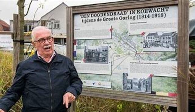
POI 1 - Den Doodendraad.
At the border crossing there is an panel with information about Koewacht in the First World War: the Belgian refugees and the Wire of Death. In September and October 1914, especially after the fall of Antwerp, about 55,000 Belgian refugees entered Zeeland here in a matter of weeks. In the summer of 1915 the Germans closed the border, from the North Sea to Vaals over a distance of about 450 km, with an electrical wire barrier with a voltage of 2,000 volts. This border fence has claimed the lives of more than 1,200 people, hence the name death wire.
No additional information.
POI 6 - Crocuses of the Wire of Death.
2018 marked the 100th anniversary of the end of the First World War. When the armistice was signed, the Wire of Death could be broken off. In memory of that terrible border barrier, a ribbon of 150,000 white crocuses was planted along the Dutch-Belgian border in the autumn of 2018 by school children from the neighborhood.
No additional information.
POI 7 - Riede polder.
The Riedepolder is a polder located to the northeast of Koewacht and is part of the Sint Jansteen, Wildelanden and Ferdinandus polders. The relatively high polder was definitively embanked in 1600. The Boschkreek is located in the wooded polder, and on the south side it has been bordered since 1664 by the Belgian-Dutch border, along which the Zoute Vaart runs, with the Tragel along it in Dutch territory. The Dutch part of the polder, which continues in the Belgian area, measures 20 ha.
No additional information.