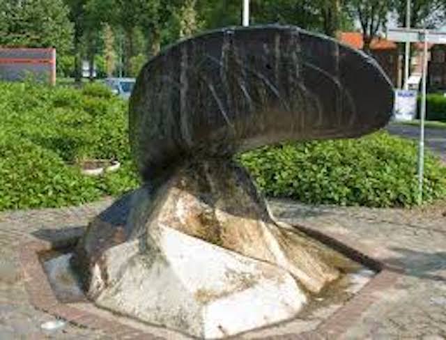
The port of Philippine was very busy at the beginning of the twentieth century. Men, women and children were waiting for the crew who returned from the mussel catch. In 2020, the port has disappeared, but the Zeeland mussels remained.
Distance: 6.2 km.
Time: 1h30.
Grade: Easy.
Type: Circular.
Gps Track: Yes.
Route description: Yes.
Wheelchair: Not suitable.
Dog: Allowed.
Height gain: Flat.
Trail: Paved and unpaved.
Marking: Walking nodes.
Hiking shoes recommended.
Advertisement.
Salty and sweet.
The walk starts at the mussel monument at the Kasteelstraat. It is tempting to already settle here on the terrace of one of the mussel restaurants well-known across the country, but you have to walk first. The reward will come later! So start the walk to node 13. On the edge of the picturesque Philipsplein, the sights are close together: the monumental dome church, the Austrian border marker and the (replica) ANWB signpost. Feel free to deviate a little from the route to noden 14. Admire the tower-stripped church in Gentsebreedstraat. Or the white Reformed church in Koningin Emmastraat, with a fish as a weather vane. How different would Philippine look if the plans of the Lord of Watervliet had continued in the sixteenth century? Then there might have been the largest port city in the County of Flanders, a competitor of Antwerp. The greatest asset of the Philippine polder that he had dammed was its strategic location on the Braakman. The Eighty Years' War threw a spanner in the works. The Spaniards built a redoubt which the Staatsen further developed into a fortress, complete with castle, bastions, raveline and port gate. After them came the French. drawings from 1751 to considerably expand the defenses were already ready. But none of those plans came to fruition. Only the street names still remind us of the fortress of yesteryear. Or the rich mussel past. Such as the Mossel shortening at the foot of the dike to node 14. This dike has been there since 1900, when the Mosselpolder was drained. A little later the road changes into an unpaved grass path. In the shelter it is pleasantly warm; an eldorado for bees and butterflies. In a large arc you follow the contours of the Mosselpolder over the Klein Stelledijk (71). At node 70 you turn right and you come to the most beautiful part of the route, at least the part that most reminds of mussel history. Along the 1700 meter long Philippine Canal, there is a lovely strolling path on both sides with a beautiful reflection of the trees in the water. From 1900 onwards, the heavily loaded mussel ships sailed from the Braakman into the port of Philippine via this canal. The canal had to keep the heavily silted tidal port accessible. In the peak year of 1911, approximately 13,000 tons of mussels were traded. The mussel fishermen have not been able to benefit from it for a long time. The harbor silted up further, no mother helped that. Neither did the sludge basin dug in 1900, which was supposed to flush sand and mud from the harbor. A black day for the village was the day the Braakman was closed in 1952. Fortunately, the land supply of mussels did not stop.
Download PDf for nodes to follow.
POI 3 - Mosselpolder.
The Mosselpolder is a polder west of Philippine, belonging to the Polders in the waterways to Axel and Ghent. The polder was created in 1900, in combination with the construction of the Philippine Canal, where it lies on the west bank. It concerned 141 ha of marsh in the Braakman.
No additional information.
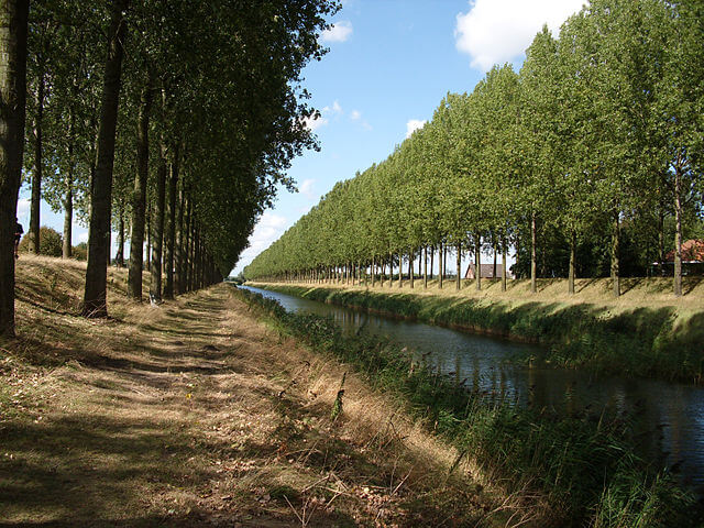
POI 4 - Philippine Canal.
The Philippine Canal was dug to allow shipping from the port of Philippine to the Axelse Gat and the Braakman. The originally 1.5 km long canal was built in 1899-1900 and extended to 4 km after 1952. The dikes along the canal are planted with trees.
No additional information.