Regional Path
Groene Woud Path


Groene Woud Path
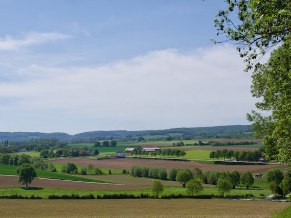
The National Landscape Groene Woud is located in the city triangle of 's-Hertogenbosch, Eindhoven and Tilburg. Within this triangle lies a wide variety of nature areas such as the Dommeldal, the Kampina, the Zegenwerp, Venrode and Eikenhorst estates, Landgoed Velder, De Mortelen, De Scheeken and De Geelders.
National Landscape Het Groene Woud.
Het Groene Woud nature trail is a series of 8 linear walks through nature reserves in Het Groene Woud with a total length of 158 kilometres. The line walks start from Boxtel, which is centrally located in Het Groene Woud, and go to places in the four corners of the world. From these places, a line walk also takes an alternative route back to the centrally located Boxtel. Line walk one and two in a southerly direction between Boxtel and Best goes through the Hezelaarsbroek and the Scheeken on the way back you pass De Mortelen and the Velder estate. Line walk three and four in a westerly direction between Boxtel and Oisterwijk goes through the Kampina and the Nemerlaer estate on the way back you pass through Oisterwijkse Vennen en Bossen and the Kampina. Line walk five and six in a northerly direction between Boxtel and Vugt goes through the Venrode and Zegenwerp estates and along the Dommel, on the way back through the Halsche Beemden, the basin of the Esschestroom and the Eikenhorst estate. And the last line walk seven and eight in an easterly direction between Boxtel and Sint-Oedenrode goes through De Geelders and along the Dommel, on the way back through De Scheeken and along the Dommel. A number of the line walks are more than 20 kilometers, for those who find that a bit long, the variant of around 16 kilometers can be walked with Liempde, Lennisheuvel and Sint Michelsgestel as a start and/or end point.
Other Regional Paths.