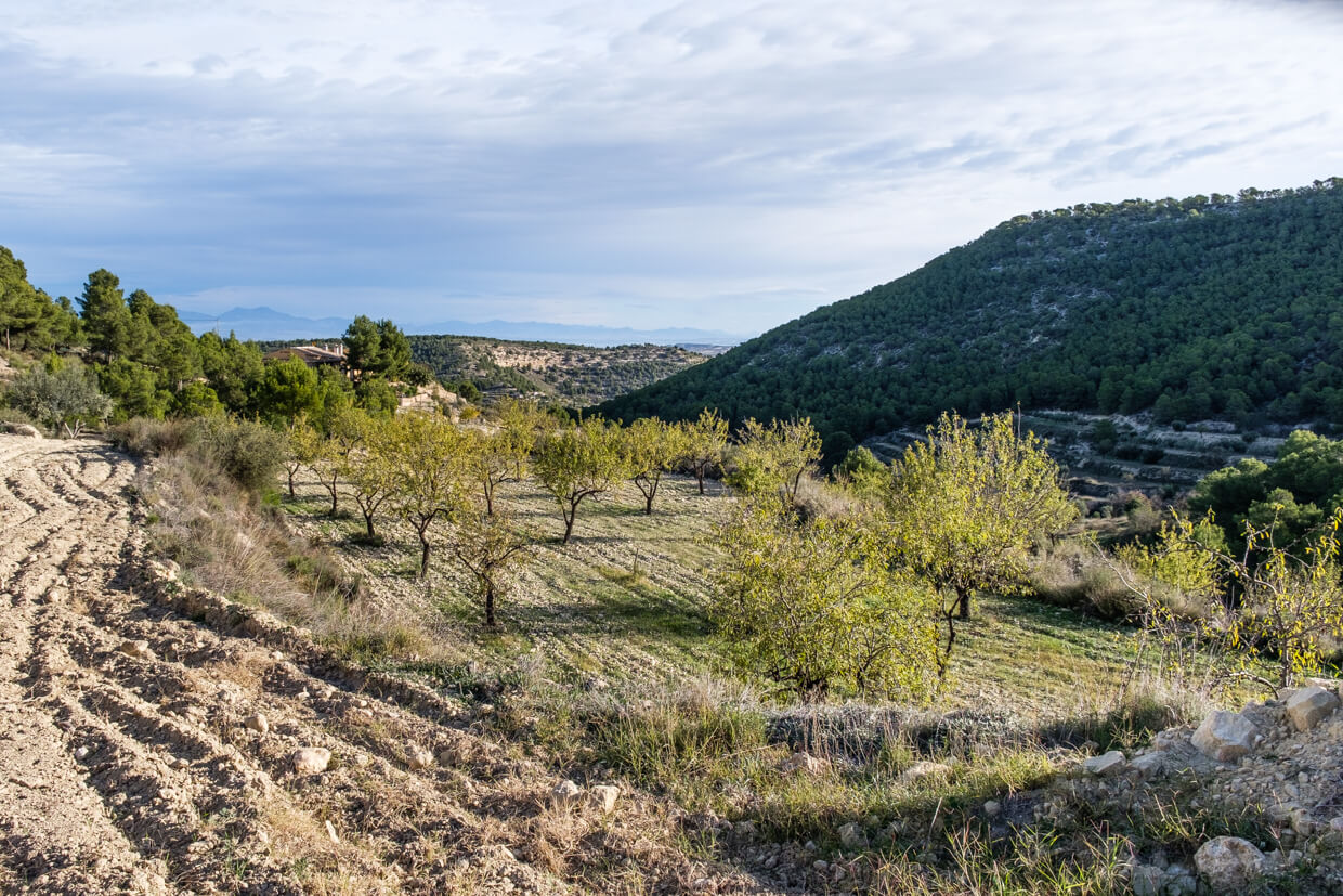
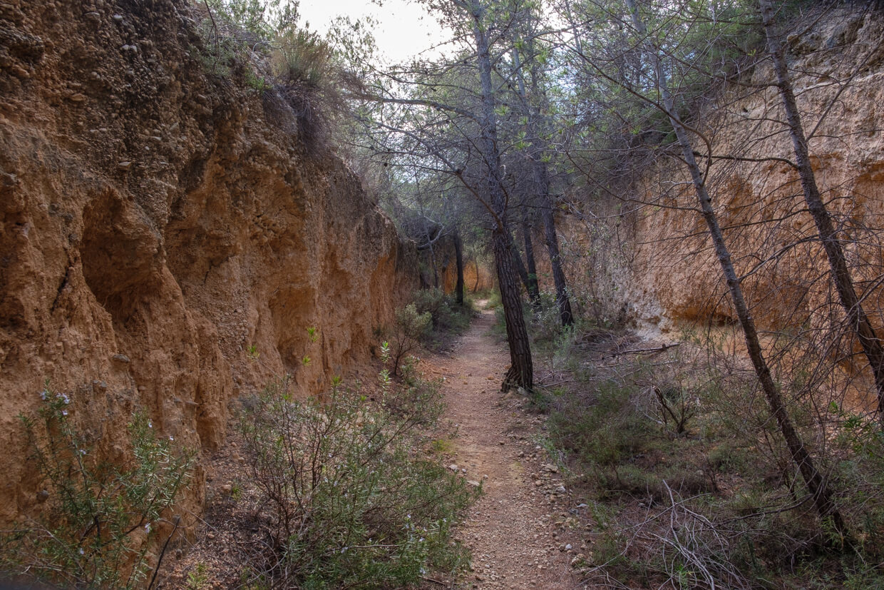
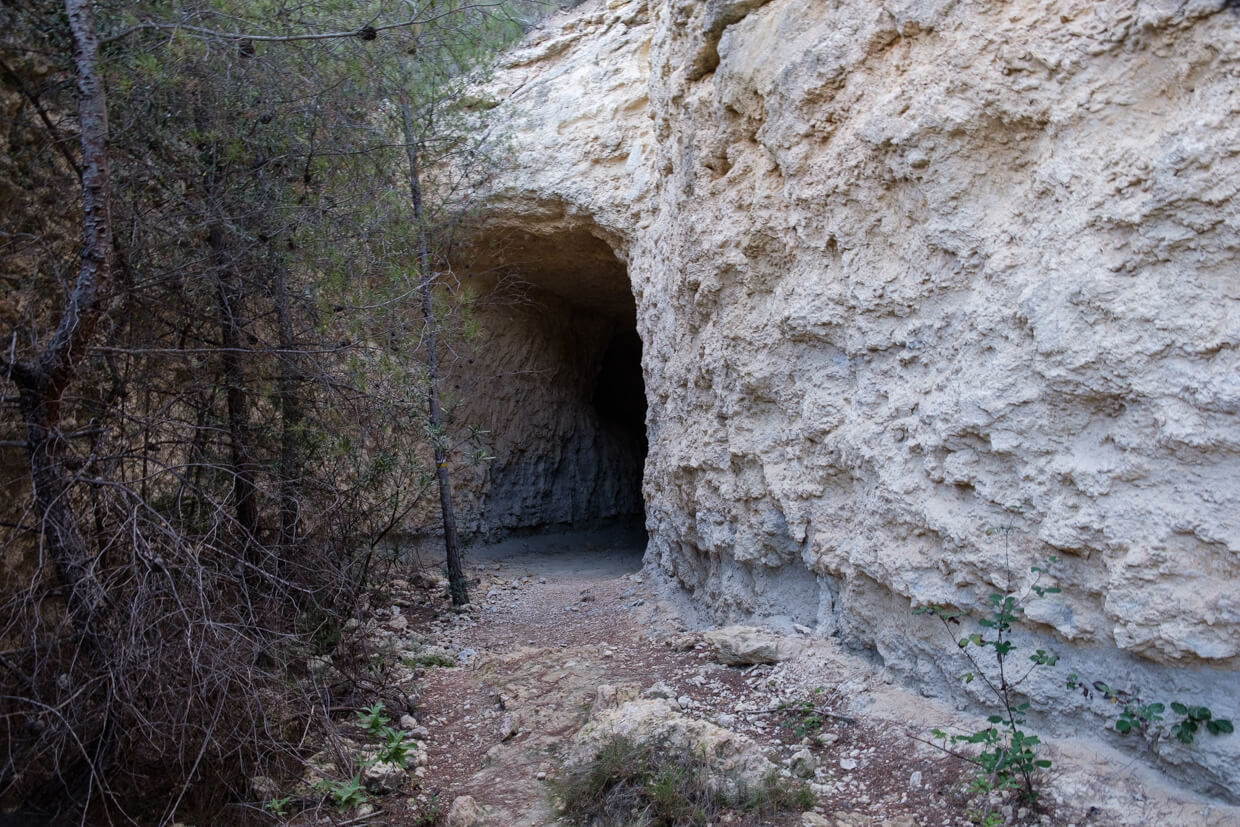
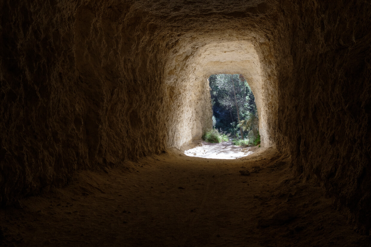
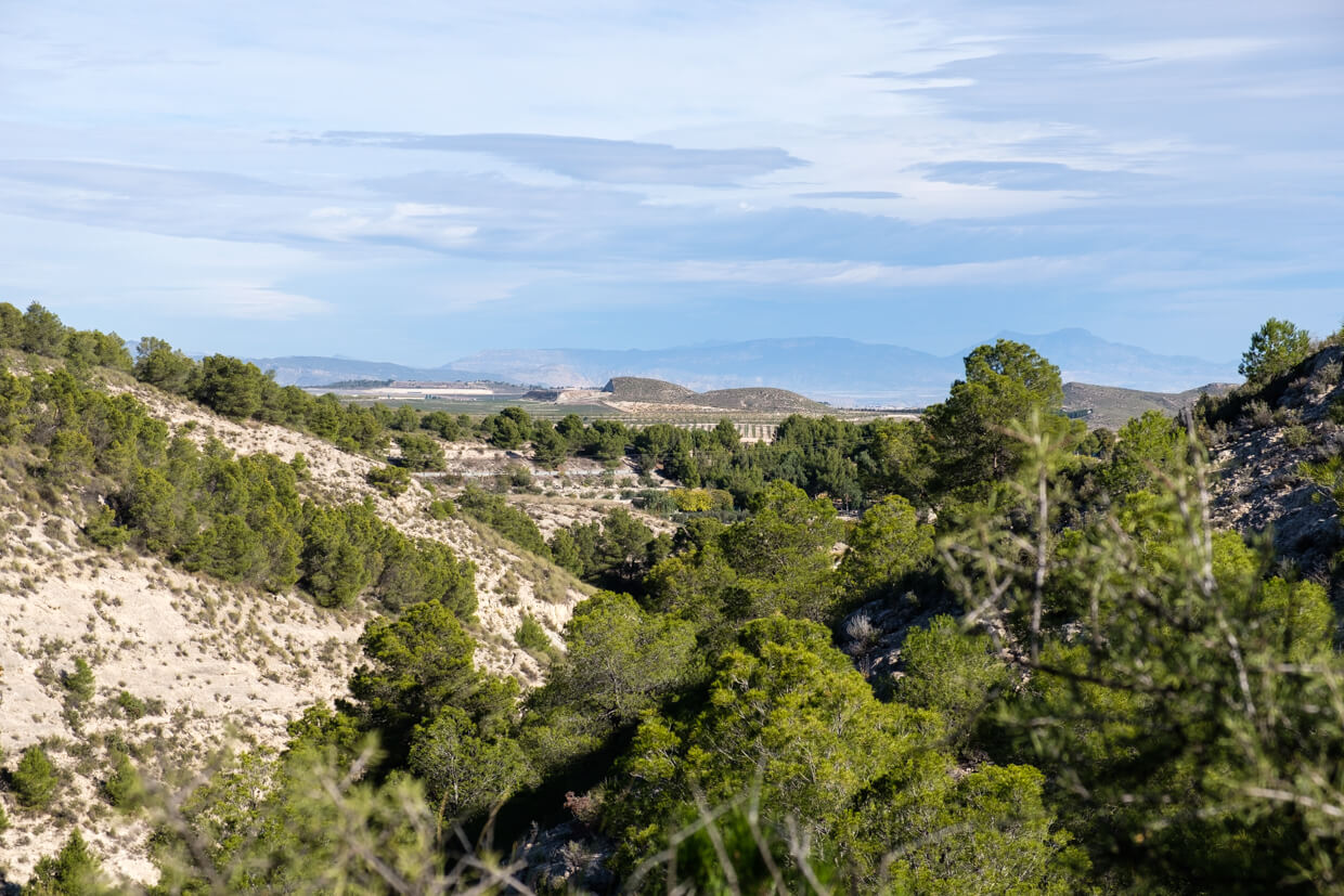
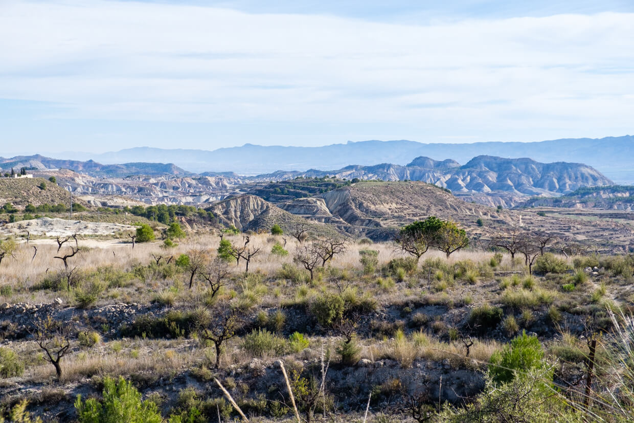
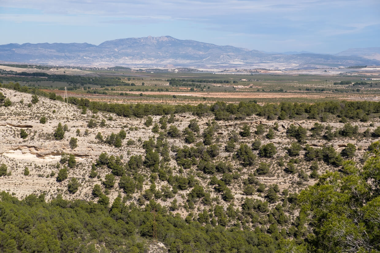
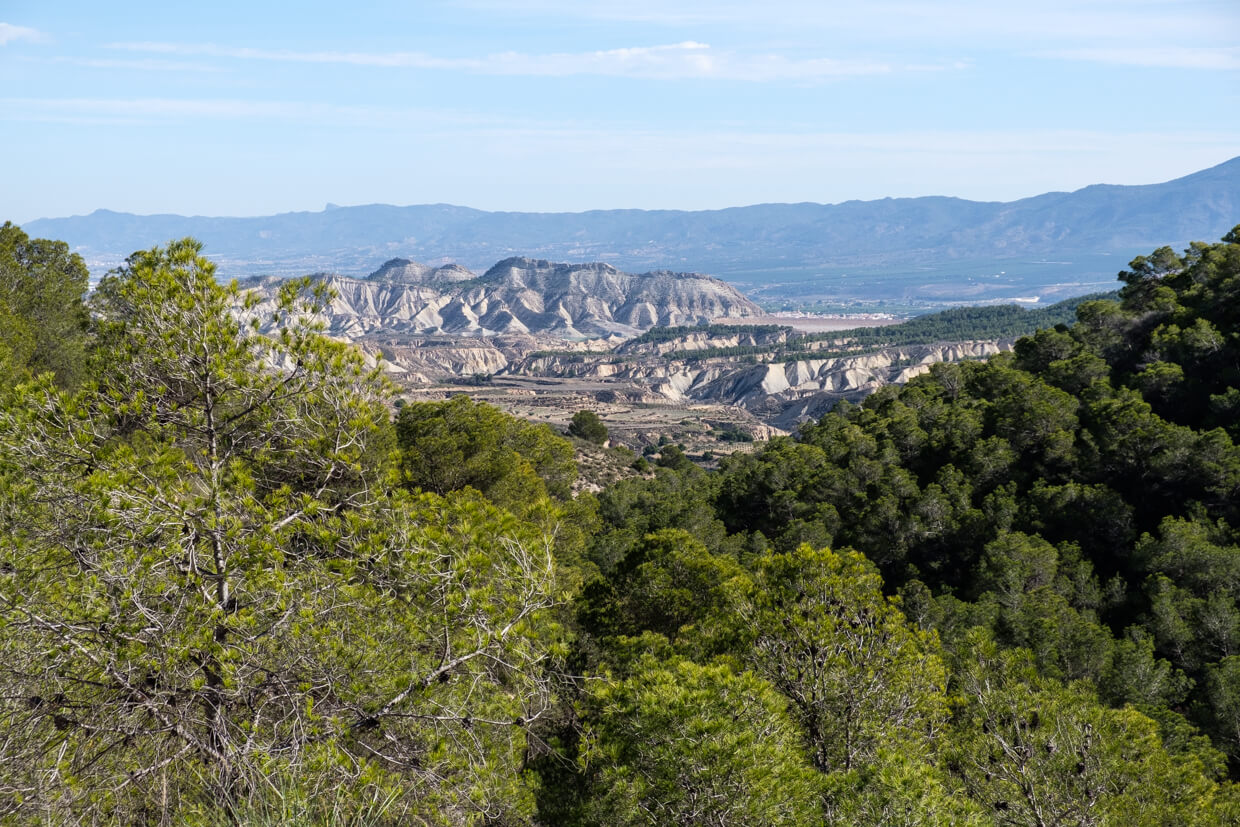
This walk gives you a good impression of how hard the local population has to work to grow almonds, figs and olives in this inhospitable area. The irrigation canal La Noguera that you follow is a silent witness of this. You walk along the ridge of the Llano del Pico with beautiful views of the Sierra Espuña and the Barranco de Gebas. You also go through a tunnel and an old excavated canal.
Distance: 8 km.
Time: 2h30.
Grade: Easy.
Type: Circular.
Gps Track: Yes.
Route description: Yes.
Wheelchair: Not suitable.
Dog: Allowed.
Height gain: 272 meters.
Trail: 80% unpaved.
Marking: PR-MU 69 - White-Yellow dash.
Hiking shoes recommended.
Advertisement.
Barranco Blanca.
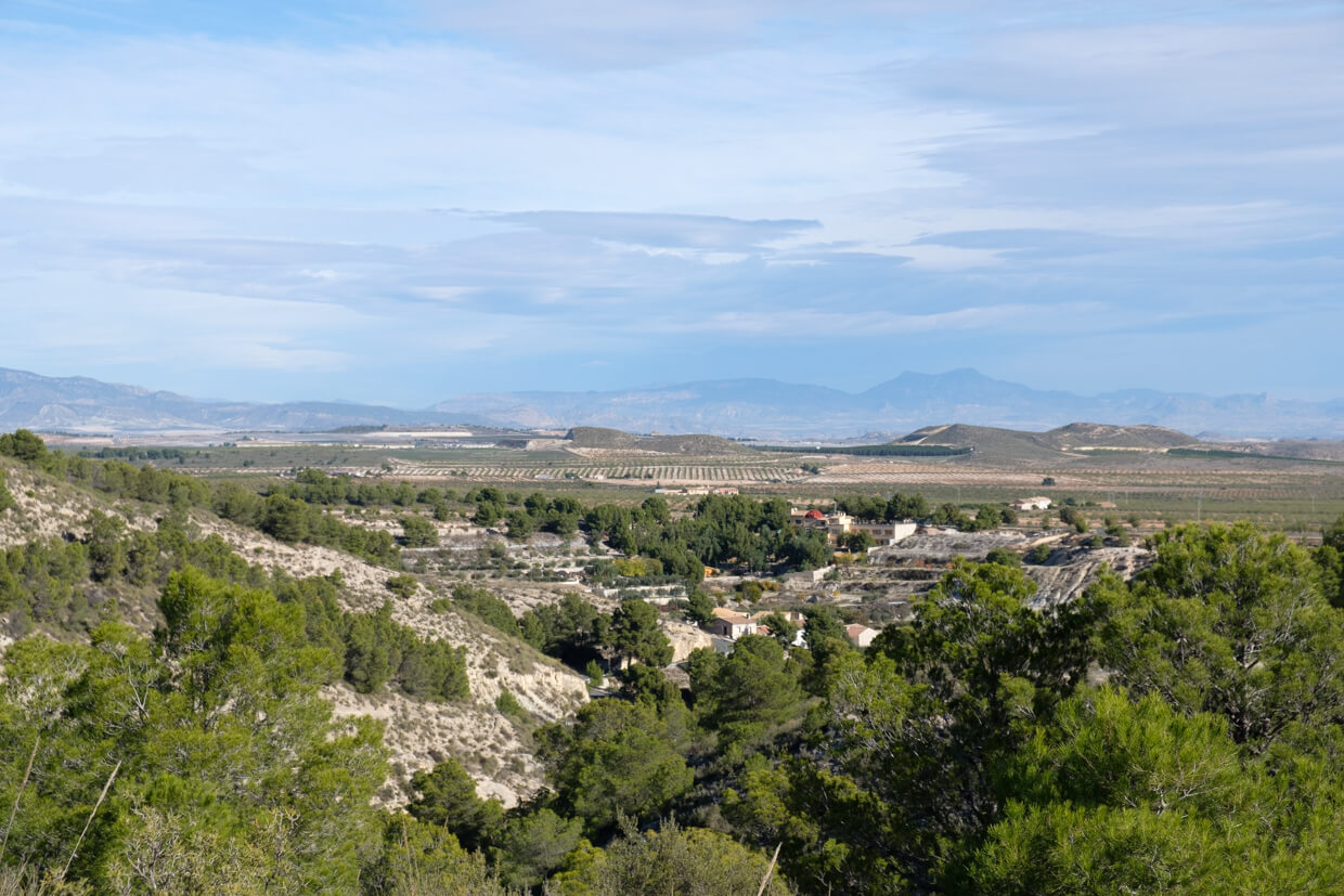
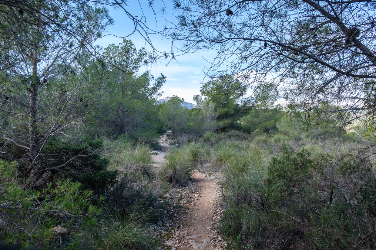
The walk leaves at the info sign next to the entrance to Camping Sierra Espuña. You walk into the village and via a staircase you arrive at an old washing place that was still used until the 50's of last century. You leave the village and walk by a rock wall where you have a nice view of El Berro. A little further you arrive at the junction where you come out of the forest on the way back. Here you keep following the GR252. Along the way you will encounter some beautiful almond orchards and eventually arrive at an irrigation canal. You literally walk on the irrigation canal until you come to the excavated canal. The path runs through the wide excavated canal with a glimpse of the valley here and there. In a bend you suddenly come at a tunnel. You go through the tunnel, a flashlight is not really necessary but can help. Once through the tunnel you start to turn to the valley where Gebas is located. At the information pole, you leave the GR252 that descends to Gebas. You continue on the flank and quickly reach the comb that keeps following you a long way. Here you have beautiful views of the surrounding valleys and on the Barranco de Gebas, the impressive moon landscape. You leave the path of the ridge to continue through a forest. At a certain moment you turn right and you start a fairly steep descent to get back on the path of the way out. From here it goes back to El Berro by the same road.
Download PDF for route description.
The white-yellow mark is present but not always visible. Often the marking is applied to a stone on the ground and not at eye level.
POI 1 - Tunnel and channel.
The intention was to lead the water from the Rambla de Algeciras via the canal to a dam. However, the dam was never built by the outbreak of the Spanish Civil War in 1936.
No additional information.