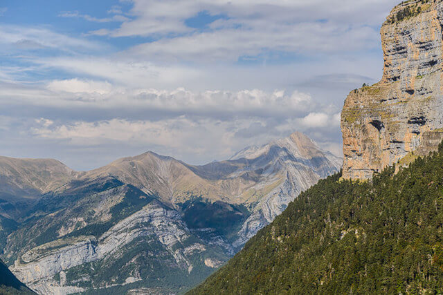
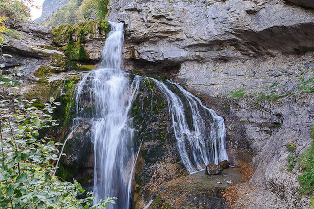
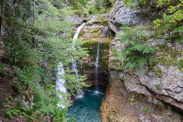
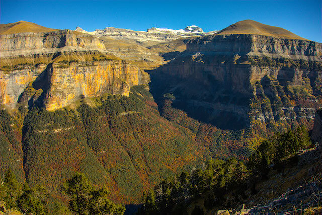
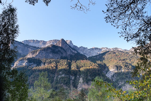
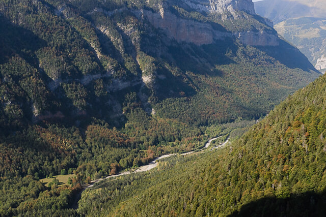
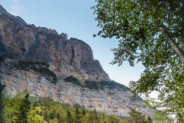
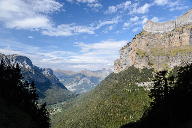
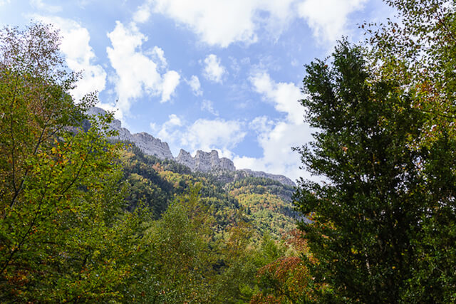
This route goes through a beech forest to the waterfall of Cuatuero, then you continue to the walls of the Pico Francata where the Faja Canarellos starts. The panoramas on the valleys are absolutely stunning. After the descent you get a nice extra with the waterfalls of the Rio Arazas.
Distance: 10 km.
Time: 3h30.
Grade: Moderate.
Type: Circular.
Gps Track: Yes.
Route description: Yes.
Wheelchair: Not suitable.
Dog: Allowed.
Height gain: 370 meters.
Trail: 100% unpaved.
Marking: Signs.
Hiking shoes recommended.
Advertisement.
National park Ordesa y Monte Perdido.
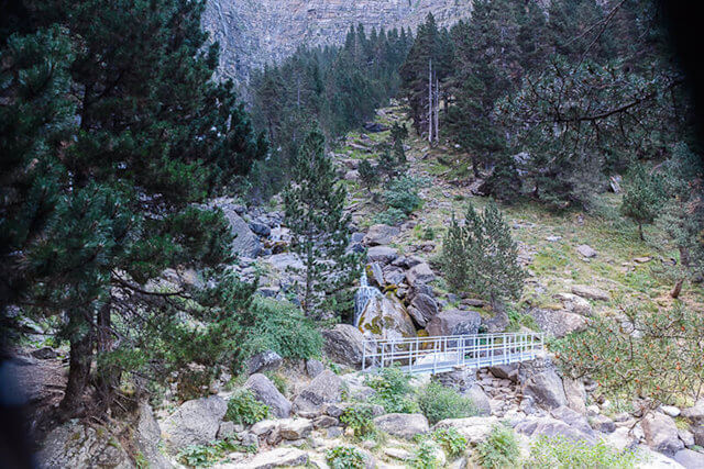
You leave at the end of the parking at the information house and go to the Virgen de Pilar. Here you bend and walk through a beech forest in the direction of the waterfall of Cotatuero. Here you cross the bridge and begin the climb to the Faja Canarellos, a panorama path in the rock wall of Tobacor. The descent goes through a forest and once you are down you walk further in the direction of the Rio Arazas with successively the waterfalls of Estrecho, Cueva and Arripas.
Download PDF for route description.
Not recommended for people with fear of heights.
If there are still snowfields, this walk is very dangerous!
POI 1 - National Park Ordesa y Monte Perdido.
The Ordesa y Monte Perdido National Park is the oldest national park in Spain. In 1918 the Ordesa valley was designated as a national park. In 1982, the area expanded from 2,100 hectares to 15,608 hectares and was renamed "Parque Nacional de Ordesa y Monte Perdido. The park contains some huge canyons: Ordesa, Añisclo, Escuain and Pineta. Of a size that is not found anywhere else in Europe. The park has a height difference of 2,600 meters, from 750 meters in Añisclo to the 3,355 meters on Monte Perdido. This is the 3rd highest peak of the Spanish Pyrenees of which Ordesa is part. Since 1997 the park also falls under the UNESCO World Heritage.
No additional information.