Mariahout, the starting point of the fourth stage, is a reclamation village. Since 1920, the wastelands in the northwest of Lieshout have been massively reclaimed. The many new farms, together with existing hamlets, formed the basis for a new village community.
Distance: 13 km.
Time: 3h00.
Grade: Moderate.
Type: Point to point.
Gps Track: Yes.
Route description: Yes.
Wheelchair: Not suitable.
Dog: Allowed.
Height gain: No info.
Trail: 74% unpaved.
Marking: See PDF route description.
Hiking shoes recommended.
Advertisement.
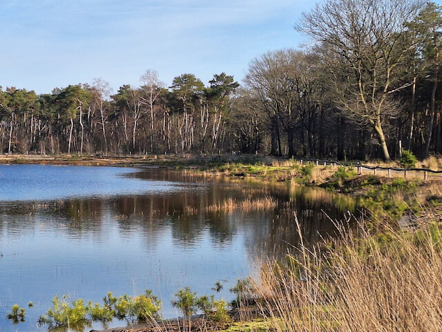
BOERDONKSE KAMPEN.
Mariahout is best known for the Lourdes Grotto, which we already passed at the end of the previous stage, and the Open Air Theater. The Lourdes Grotto is a copy of the original cave in Lourdes near the church. The stage goes through the Lieshoutse Bossen, the Boerdonkse Kampen with the nature reserve 't Geregt to the north, along the Zuid-Willemsvaart canal and along the Goorloop stream to the Donk in Beek en Donk. The Lieshoutse Bossen, also called Mariahoutse Bossen, north of Mariahout is a young heathland reclamation area where mainly Scots pine and spruce trees were planted on the then much larger Lieshoutse Heide, the rest of the heathland was developed into agricultural area. In the forest area there is a beautiful narrow fen, the Torreven, and the Vossenbergven, which has been restored since 2019. The Boerdonkse Kampen is an agricultural area with some small forest plots and in the north the nature reserve 't Geregt, which unfortunately falls just outside the boundary of the municipality. The stage goes along this area for a while, what is striking is that both the Boerdonkse Kampen and the nature reserve 't Geregt are located lower than the Zuid-Willemsvaart. At the point where the canal is left and the Goorloop stream is followed, the Goorloop passes under the canal to flow further into the Aa.
Download PDF for route description and map.