Stage 5, also the last stage, starts at the Piet van Thielplein on the Donk in Beek en Donk. The stage goes through the Eyckenlust estate with Eyckenlust Castle, past the Holy Blood Mission Monastery, also known as Broeks Monastery. The stage then goes through the De Biezen and Milschot nature reserve, through Het Broek, through 't Gulden Land, De Beemd and along the Wilhelmina Canal and the Zuid-Willemsvaart to the end point, the church in Beek in the town of Beek en Donk.
Distance: 17 km.
Time: 3h30.
Grade: Moderate.
Type: Point to point.
Gps Track: Yes.
Route description: Yes.
Wheelchair: Not suitable.
Dog: Allowed.
Height gain: No info.
Trail: 60% unpaved.
Marking: See PDF route description.
Hiking shoes recommended.
Advertisement.
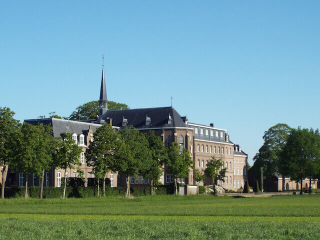
BROEK'S MONASTERY.
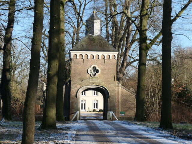
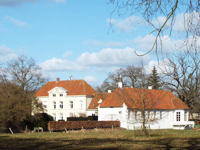
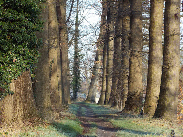
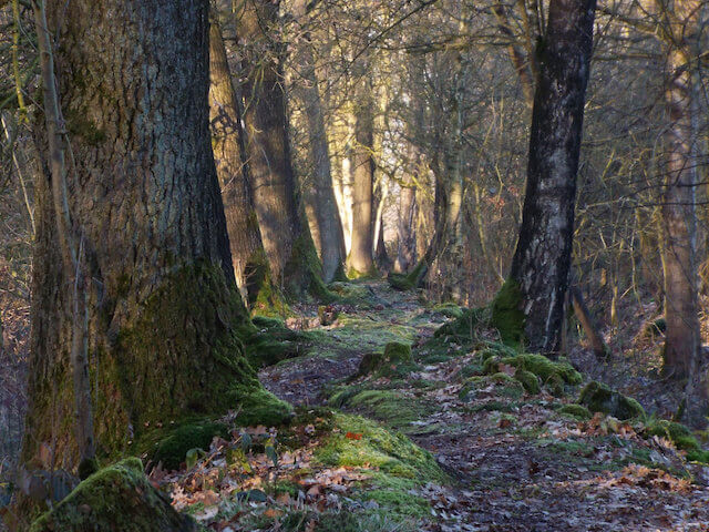
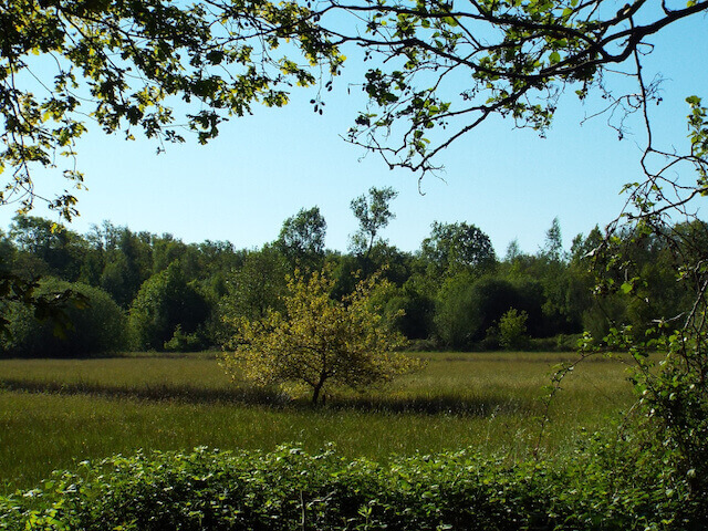
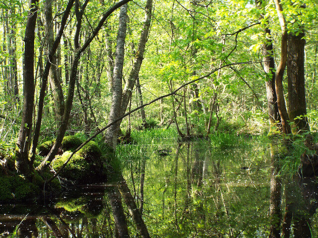
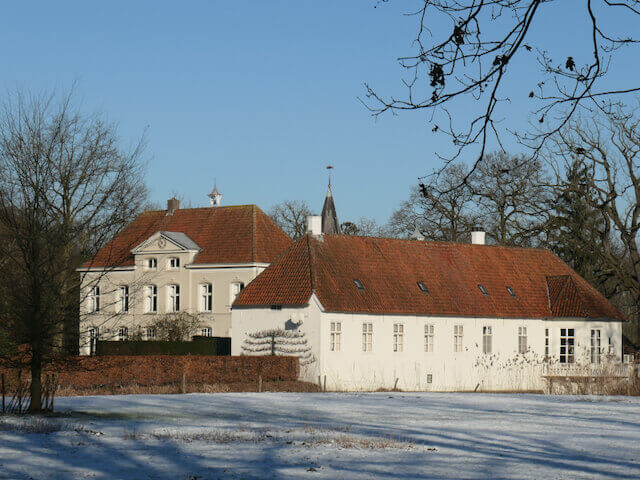
During this stage, you pass the N279 twice, which cuts through the eastern part of the municipality. The first time from the Eykenlust estate to the Holy Blood Mission Monastery, this part goes through an agricultural area with greenhouses. And the second time from Het Broek to 't Gulden Land. The Eyckenlust castle is located on the Aa stream, the estate consists partly of forest and a few farms. The oldest part of the castle, the gatehouse, dates from around 1500, it has a natural stone entrance gate and a turret. It is not known when the castle was built, but it is known that it was regularly renovated, such as a stone with the date 1658. The Holy Blood Mission Monastery was built because the Saint Joseph monastery in Helden-Panningen became too small. For more space, the congregation had purchased a piece of land with a farm in Aarle-Rixtel, on which a large monastery was built, the current Holy Blood Mission Monastery. The associated farm, a long-façade farm, is older and dates from around 1845. De Biezen is a nature reserve consisting of wet deciduous forests on a loamy soil. There are poplar plantations, dry oak forests, swamp forests and poor flowery grasslands. On the edge of De Biezen, which forms the border with the municipality of Gemert-Bakel, the walking tour follows parts of a landwehr that formed the border of the former municipality of Aarle-Rixtel and Bakel. Such old landwehrs were usually constructed in the Middle Ages and consist of a raised sand bank. The landwehr in De Biezen dates from the period 1350 to 1450 and followed a natural stream, De Ymelbeke. In a charter from May 1288, De Ymelbeke is already mentioned as a border, while at the same time the presence of a rampart is mentioned. In De Biezen the landwehr is not immediately noticeable because De Biezen was developed in the 19th or 20th century as a rabattenbos, also raised sand banks with ditches in between for drainage. In ’t Gulden Land the Hermeanderende Aa is followed. The old course of the Aa was cut off from the main course with the construction of the Zuid-Willemsvaart. The isolated area is a newly developed nature reserve in which the old course of the Aa has been restored. On the other side of the Zuid-Willemsvaart the stage goes through De Beemd, a small nature reserve managed by the IVN in the lowest part of Aarle-Rixtel. The last part of the stage goes, to emphasize the term ‘Waterpoort van de Peel’ along the Wilhelminakanaal and the Zuid-Willemsvaart to the church in Beek, the end point of Het Laarbeekpad.
Download PDF for route description and map.