Walk to the northernmost point of East Zeeland Flanders. On the Radar Tower you have a beautiful view of the Western Scheldt and further you walk through a beautiful piece of nature on the Doorn dike.
Distance: 11 km.
Time: 2h45.
Grade: Easy.
Type: Circular.
Gps Track: Yes.
Route description: Yes.
Wheelchair: Not suitable.
Dog: Allowed.
Height gain: Flat.
Trail: Paved and unpaved.
Marking: Walking nodes.
Hiking shoes recommended.
Advertisement.
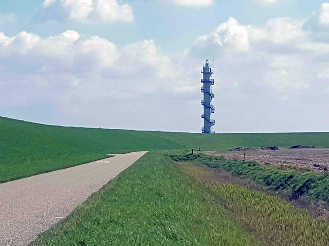
View of the radar post.
You go in the direction of the Catharina Church, but first you pass the craft brewery De Kip on Kipstraat 2. More information: www.brouwerijdekip.nl. You turn left into the Dorpsstraat and just past the cemetery you take the unpaved path to the right. The path ends in the Weststraat. Here you turn left and follow the Weststraat until the T-junction with the Lageweg. Here you turn right and follow the Lageweg until node 38. Here you go straight on in the direction of node 36 (Zeedorp).
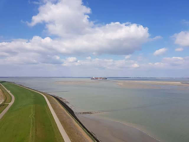
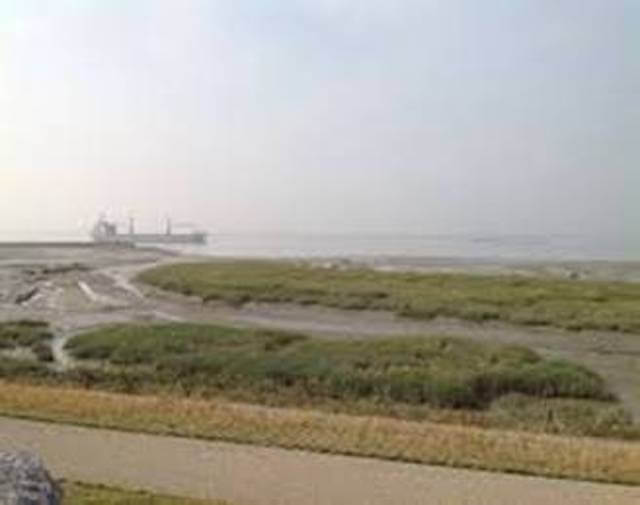
At node 36 you come to the Westerscheldedijk. Here you turn right towards Knuitershoek. (node 39) In addition to the large sea-going vessels, see here also the marsh area Buitendijks. The route goes through quiet polder dikes towards Krevershille. (node 78) Here you can climb the radar post and in clear weather see Zuid Beveland, among others, over the Western Scheldt. In good weather, the beaches on the right towards Perkpolder are also a pleasant place to relax.
From node 79 the walk continues on a special piece of nature. This leafy Doorndijk with many types of trees and shrubs ends at the Kalverdijk at node 14. Continue over the village of Noordstraat and via the Drogendijk node 15 you return to Ossenisse. On the edge of the village you will pass the Owls and bird of prey farm Het Uilennist.
Download PDf for route description.
POI 1 - Westerschelde dike.
You can enjoy an impressive view on the Westerschelde dike. The enormous container ships that have the port of Antwerp as their final destination glide silently through the water. Oystercatchers and shelducks search for food on the muddy edges at the base of the dike. Redshanks are also looking for a meal.
No additional information.
POI 2 - Molenpolder.
The polder was built around 1200 by the monks of the Ten Duinen Abbey. At the same time they built the Nieu Hoes or Nieuhof polder. However, this was swallowed up by the water in 1591 and never rediked. In 1632, part of the Molenpolder in the Western Scheldt also disappeared. The remaining part is 52 hectares.
No additional information.
POI 3 - Radar Tower.
The radar tower at Ossenisse, near the hamlet of Kreverhille, offers a wide view of the Western Scheldt from a height of thirty meters.
No additional information.
POI 4 - Kievietpolder.
The polder, built around 1200 by the monks of Ten Duinen Abbey, measures 24 hectares and was traditionally known as the Keynes or Keyvit polder.
No additional information.
POI 5 - Noordhofpolder.
Established around 1200 as a closed Noortpolder, it was later called Noordhofpolder, after an uithof that the monks of the Ten Duinen Abbey founded here, next to the already existing Hof te Zande. A farm of that name still exists.
No additional information.