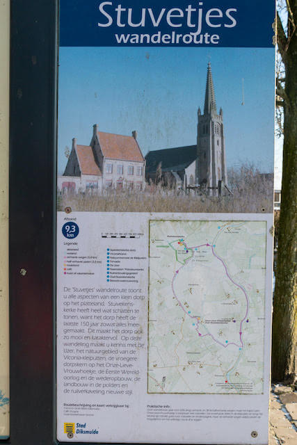
The Stuvetjes walking route takes you along all aspects of a small village in the countryside: Stuivekenskerke. This beautiful and characterful village has a lot of treasures to offer, because it has seen just about everything in the last 150 years! During this walk you will get to know the Yser, the nature reserve of the Viconia Kleiputten, the former village center on the Onze-Lieve-Vrouwhoekje and of course the First World War.
Distance: 9 km.
Time: 2h30.
Grade: Easy.
Type: Circular.
Gps Track: Yes.
Route description: No.
Wheelchair: Not suitable.
Dog: Allowed.
Height gain: Flat.
Trail: Paved and unpaved.
Marking: Hexagonal signposts.
Hiking shoes recommended.
Advertisement.
Viconia.
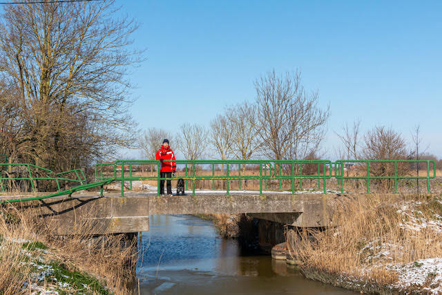
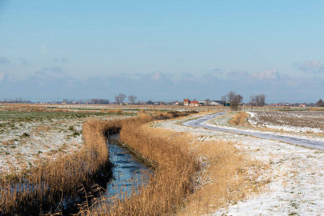
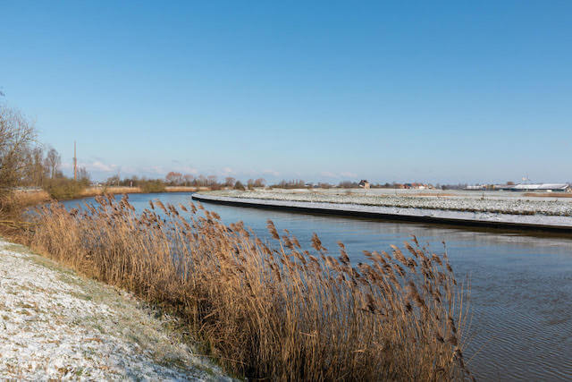
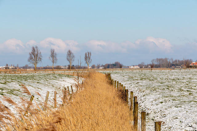
We leave the church, but not without having seen the information boards next to the cafe. Here we learn something about Stuivenkenskerke and its history. Then we follow hexagonal signs “Stuvetjes-walking route”. We pass the first point of interest, Kasteelhoeve Viconia, after only 200 meters. Then keep following the asphalt road until the Yser. Turn right here and follow the dike after a long course along the river turn right into the polders. Keep following the signs. We now walk along with the front line. After the Onze-Lieve-Vrouwehoekje we walk back into the polders to the nature reserve Viconia-Kleiputten. At the end we arrive next to the Viconia Kasteelhoeve and we walk back to the church.
Well marked.
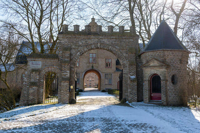
POI 1 - Castle farm Viconia.
The name refers to the former Norbertines and is now a holiday hotel. Its origins date back to the 12th century. Until the Geuzen, Ostend robber gangs and finally the French Revolution heralded the end of monastic life. After this, the farm came into the possession of the De Grave family who converted the site into an estate. During the Battle of the Yser, the Germans conquered Chateau Vicogne and converted it into a German outpost. The farm was completely destroyed but rebuilt in 1925 in a pseudo-Renaissance style.
No additional information.
POI 2 - Nature reserve Viconia kleiputten.
The Viconia clay pits in Stuivekenskerke are mainly known for their great birdlife. The seven very different ponds and the newly excavated area, the wet and relief-rich hay meadows, the hedges and the swamp grove provide a wide variety of biotopes on a relatively small area. Moreover, the nature reserve is conveniently located along the Yzer and between wetlands such as the Yser estuary, the Handzame valley and the Yzerbroeken. You pass 2 bird watching huts.
No additional information.
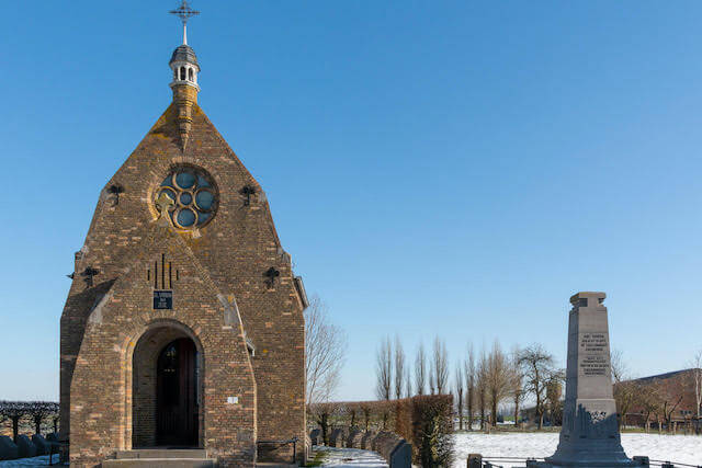
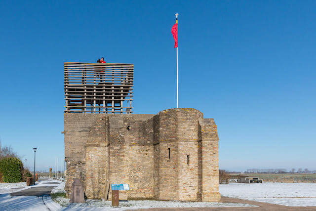
POI 2 - The Onze-Lieve-Vrouwenhoekje.
A special place because here the German army was brought to a standstill in the First World War. It is now a protected war site, with the memorial chapel Onze-Lieve-Vrouw-ter-Zege. A watchtower was placed on top of the ruins of the destroyed church tower. An orientation table indicates 35 important places from the war. From here you have a special view of the battlefields of the Yzer.
No additional information.