Walking route
Ouden Doel.


Ouden Doel.
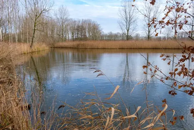
This walk through the Groot Saeftinghe Border Park goes along Prosperpolder Noord to the Paardenschor on the Scheldt. Here you can admire the entire region from the radar tower. On the Scheldedijk you look inland on Doelpolder Noord and the Brakke Kreek. You can observe the wide variety of meadow birds on two viewing screens. Along the edge of Properpolder South you walk back to Prosperdorp with the church tower as a beacon.
Distance: 11.5 km.
Time: 2h30.
Grade: Easy.
Type: Circular.
Gps Track: Yes.
Route description: Yes.
Wheelchair: Not suitable.
Dog: Allowed on leach.
Height gain: Flat.
Trail: 85% paved.
Marking: Walking nodes.
Hiking shoes recommended.
Groot Saeftinghe border park.
From the hamlet of Prosperdorp you walk to the ring dike at Prosperpolder Noord. You follow the ring dike along the project area of the Hedwige-Prosper project, which is in full development. Here everything is being prepared to welcome the mudflats and salt marshes of the new tidal area. The area within the dike, good for 465 hectares, will be depoldered and will connect the Paardenschor near Ouden Doel with the Verdronken Land van Saeftinghe. This creates a unique tidal area of more than 4000 hectares. You pass the hamlet of Ouden Doel and arrive at the radar tower Ouden Doel. The lookout on the first floor is freely accessible via an iron staircase and offers a panoramic view of the harbor, the Scheldt and the surrounding nature. You are now going over the Scheldt dike where you will see the nature reserve Doelpolder Noord and Brakke Kreek on the right. When you leave the dike you walk next to this nature reserve. A high dike separates the walking path from the newly constructed meadow bird areas, but on the way you come across two viewing screens so that you can observe many meadow birds. At the hamlet of Rapenburg you follow the Zoetenberm, an old cobbled road on the dike to the edge of Prosperpolder South. You follow the edge of this nature reserve to Prosperdorp. Here you make a small detour along the Prosper farm. The manor farm with mill is protected as a monument and is being converted into a welcome gate for the area.
Download PDF for walking nodes to follow and map.
Bring binoculars.
POI 1 - Information center.
In the information center on the Zoetenberm you can discover the works in the Hedwige and Prosper polders up close. A large visualisation, an animation film and a range of maps and images show you what the future Grenspark Groot Saeftinghe will look like within a few years. Open on Monday (11am - 4.30pm), Wednesday (1pm - 4.30pm) and Thursday (9am - 4.30pm). Excursions through the area also regularly depart from the visitor center.
No additional information.
POI 2 - Radar tower Ouden Doel.
The new radar tower Ouden Doel from 2016 replaces an older tower that stands right in the future nature reserve and therefore has to disappear. The lookout on the first floor is freely accessible via an iron staircase and offers a panoramic view of the harbor, the Scheldt and the surrounding nature.
No additional information.
POI 3 - Doelpolder Noord and Brakke Kreek.
A high dike separates the footpath from the newly created meadow bird areas Doelpolder Noord and Brakke Kreek. Both zones were set up as nature reserves to compensate for the nature that was lost during the construction of the Deurganck dock. The result: a paradise for meadow birds such as redshank, black-tailed godwit and garganey in the spring, and waders, ducks and geese in the winter. Walking on the dike is prohibited, so as not to disturb the birds. There are two viewing huts along the way to watch the residents flying in and out.
No additional information.


