The boundary between peace and war was literally put under tension during the First World War. This walk takes you past influential locations at the time of WWI. You pass the new and old town hall of Baarle-Hertog, the former Belgian post office and the headquarters of the Dutch commander. But also the town hall of Baarle-Nassau, the former train station, the locations of the Belgian military broadcasting station and the soldiers' barracks on Loveren. There was the gate at the fence around Baarle center, the Red Cross post of the Dutch army and several other places that remind of WW1. Never before has a border made such a big difference.
Distance: 4.2 km.
Time: 1h00.
Grade: Easy.
Type: Circular.
Gps Track: Yes.
Route description: Yes.
Wheelchair: Not suitable.
Dog: Allowed.
Height gain: Flat.
Trail: 100% paved.
Marking: Walking nodes.
Advertisement.
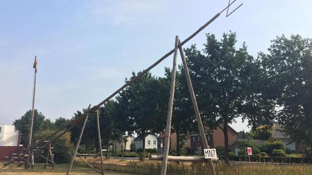
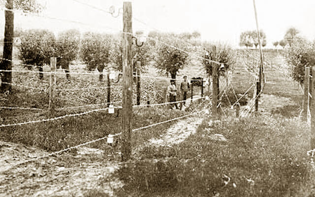
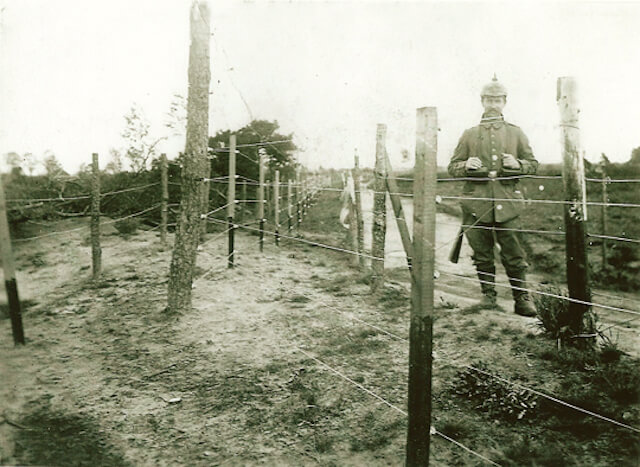
Resistance Path.
During World War I, Belgium was occupied by the German army, the Netherlands was neutral. The Belgian-Dutch border was the dividing line between war and peace. Baarle-Nassau was under siege, Zondereigen was occupied by the German army and the Belgian enclaves remained free. The previously peaceful Baarle-Hertog was overrun by thousands of Belgian refugees and a thousand Dutch soldiers during the first months of the war. These soldiers were billeted in Baarle-Nassau in the Netherlands, but because of the entanglement between the two Baarlese municipalities, they also moved into Belgian territory during the day. Along the way there is a reconstruction and four information boards with two recorded stories, which can be listened to on site after scanning a QR code or downloaded in advance via www.dodendraad.org.
Download PDF for a detailed route description.