
Walking route
Gullurias route.


Gullurias route.
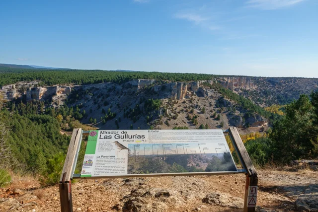
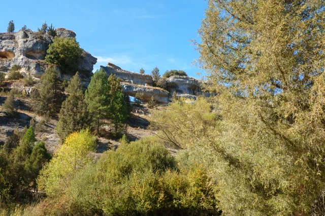
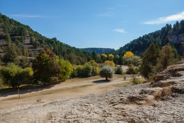
This hike in the Canon del Rio Lobos Natural Park crosses a stretch of heathland and through a beautiful juniper forest to the Mirador de las Gullurias viewpoint, offering spectacular panoramic views of the gorge's deeply eroded rock walls and the surrounding forests. The route continues along the riverbank to the Hermitage of San Bartolomé, a Romanesque Templar church dating back to the 12th century, and the Cueva Grande, a magnificent cave formerly used for contemplation. You'll have to discover for yourself why the route is called Senda Gullurias.
Distance: 11 km.
Time: 3h30.
Grade: Moderate.
Type: Circular.
Gps Track: Yes.
Route description: Yes.
Wheelchair: Not suitable.
Dog: Allowed on leach.
Height gain: 220 meters.
Trail: 98% unpaved.
Marking: White-Yellow PR-SO67 and PR-BU65.
Hiking shoes recommended.
The path of the woodlarks.
We begin the trail next to the car park opposite the park’s visitor centre. Right at the start, we find a number of beehives on the left-hand side of the path; their presence indicates that many aromatic plants grow in this area. Beekeeping was an important source of income, which led to the planting of rosemary. The trail climbs up through the Barranco del Molino gorge. Behind us looms the spectacular castle of Ucero, a symbol of medieval power. We continue until we reach the first lime kiln. As the name suggests, it was used to extract lime, which was once used to whitewash the walls of houses. Beyond the lime kiln, we reach the moorland, a flat area known as El Esplegar. Lavender was harvested here for perfume production, an activity that continued until the 1960s. The trail continues, crossing three valleys: the Vallejos Hondos, Las Torcas, and the Barranco de las Tasugueras. At this last ravine, the name already indicates that we are in the habitat of the badger, locally called Tasugos. The route descends gently and we enter a fascinating forest of Spanish juniper, a species characteristic of the gorge. A little further on, we arrive at the impressive Gullurías viewpoint. Here, they say: "On St. Matthew's Day, the woodlarks sing and become like night and day." This refers to the woodlark, a small woodland bird that you can easily spot flying among the junipers. From the Gullurías viewpoint, you can see the pine forests of Soria and Burgos in the foreground. In the distance, the peaks of the Iberian Mountains, including Urbión Peak, rise up. With a bit of luck, you can enjoy the majestic flight of the golden eagle, the griffon vulture, and the Egyptian vulture. From the viewpoint, we pass through a dense forest and reach the path known as the Gayubares, due to the abundance of bearberry, a medicinal plant that covers the slopes. The route then descends to the banks of the Rio de Lobos. We follow the riverbank on a well-maintained path to the Hermitage of San Bartolomé. This 12th-century Templar church is built in the Romanesque style with local limestone. It is said that the hermitage contains coded messages from the Templars. Every year on August 24th, during the celebration of San Bartolomé, a procession takes place to the hermitage. Right next to the hermitage lies the impressive Cueva Grande. It is a natural cave, also known as the Cueva de los Murciélagos (Bat Cave), which was once used for contemplation. You can enter a fairly large section of the cave. From the cave, we walk back to the river, which we now follow until we reach the starting point. Here, you can visit the visitor center.
Download PDF for route description and map.
Well marked.
During wet periods, the paths along the river can become muddy.


Walks Soria.


