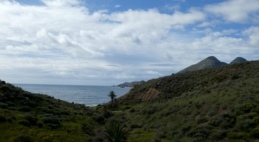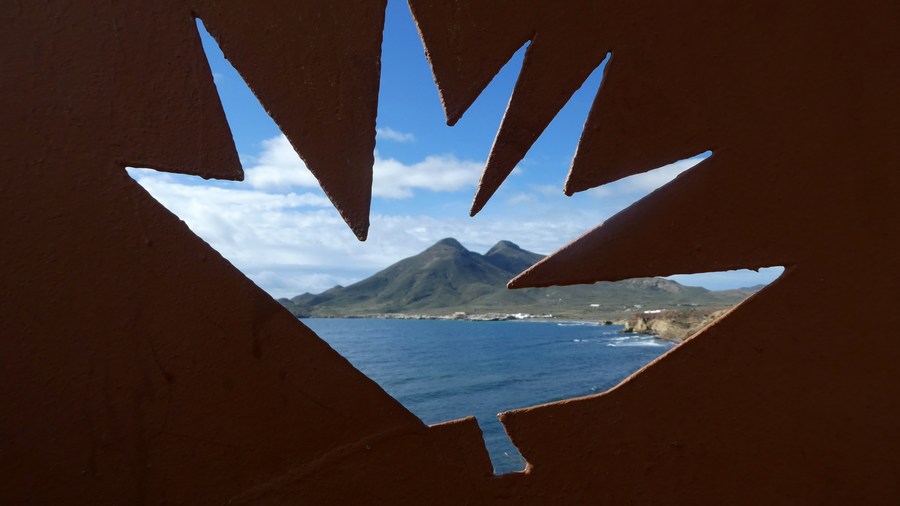
The rugged mountain and rocky landscape of Cabo de Gata is isolated and geologically one of Europe's most special. The Sierra de Gata mountain range is the largest volcanic rock formation in Spain, with sharp peaks and ocher-colored steep rocks.
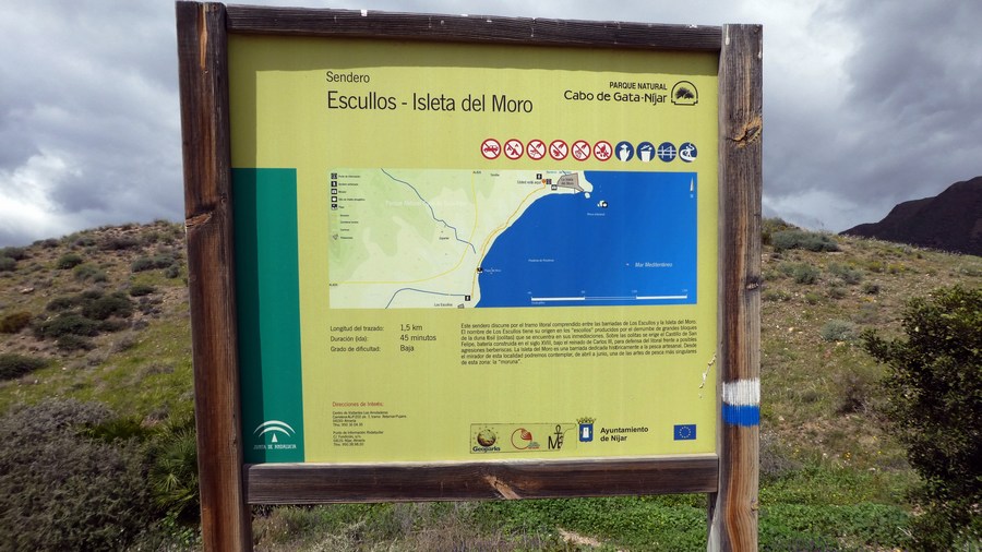
Distance: 9 km.
Time: 2h30.
Grade: Easy.
Type: Back and forth.
Gps Track: Yes.
Route description: No.
Wheelchair: Not suitable.
Dog: Allowed.
Height gain: 200 meters.
Trail: Paved and unpaved.
Marking: None.
Hiking shoes recommended.
Advertisement.
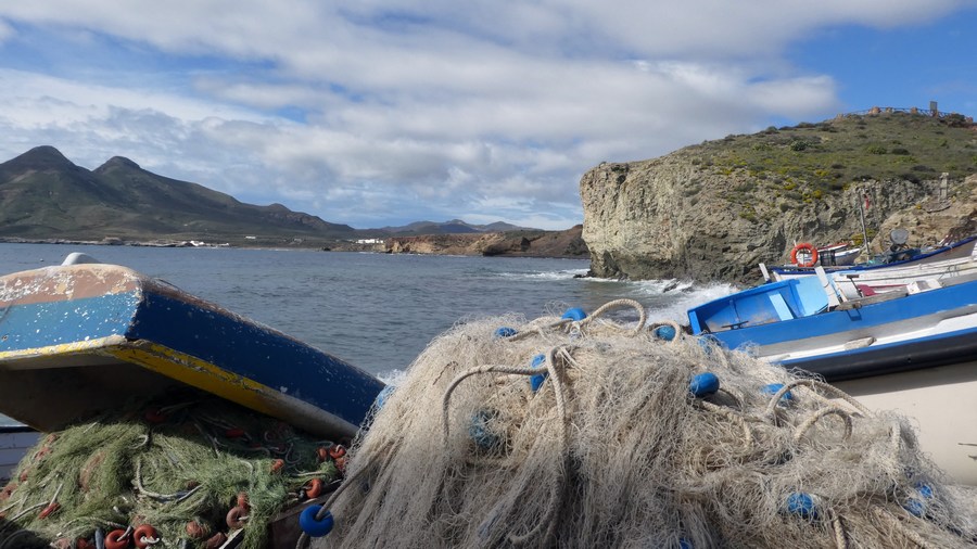
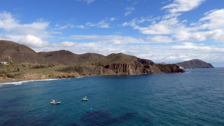
Fishing village La Isleta del Moro.
Beautiful walk from Los Escullos to the small fishing village of La Isleta del Moro. The walk goes along the coast, over the rocks to the small peninsula. Along the way you have beautiful views of the bay and the two extinct volcanoes. From the rock in Isleta del Moro you have a beautiful 360 ° view. The tour is completely unpaved and even for the most part runs over a narrow footpath. The way back goes approximately along the same road.
POI 1 - Cabo De Gata-Nijar Naturel Park.
Covering 45,663ha in the southeastern corner of Spain, Cabo de Gata-Níjar is Andalucia's largest coastal protected area, a wild and isolated landscape with some of Europe's most original geological features. The eponymous mountain range is Spain's largest volcanic rock formation with sharp peaks and crags in ochre-hues. It falls steeply to the sea creating jagged 100m-high cliffs, which are riven by gullies leading to hidden coves with white sandy beaches, some of the most beautiful in Andalucia. Offshore are numerous tiny rocky islands and, underwater, extensive coral reefs teeming with marine life. High temperatures (an annual average of 18°C) and the lowest rainfall in the Iberian peninsula (200mm annually on average) has created a large semi-desert area, with characteristic shrubby vegetation and dwarf fan palms. But the park also encompasses an outstanding variety of habitats, from coastal dunes, beaches, steep cliffs, saltpans, a substantial marine zone of 12,200ha, saltmarshes, inland arid steppe and dry river beds. Designated a Unesco Biosphere reserve in 1997, the park shelters an extraordinary wealth of wildlife, including many rare and endemic plants and endangered fauna. One of Spain's most important wetland areas for breeding and overwintering birds is called the Salinas de Cabo de Gata, the saltwater lagoon that runs parallel to the beach and is separated from it by a 400m-wide sand bar. Located between San Miguel and the Cabo de Gata headland, this lagoon is of outstanding ecological interest, particularly for its birdlife. The salinas (saltpans) are the only ones still in operation in eastern Andalucia. Phoenicians, Romans and Arabs were all attracted by the area's rich mineral deposits like agate, jasper and, most importantly, gold, which was extracted from the mines of Rodalquilar. A jetty at Agua Amarga was used for loading ore onto cargo boats. Other inhabitants were Berber pirates, who sought refuge in this remote corner of Andalucia, but the dozen lookout towers dotted along the coast are evidence of attempts to repel them.
Visitors Centre.
Los Amoladeras, between Retamar and San Miguel de Cabo de Gata on the AL822.