Sluiskil is inextricably linked to activity. From the very beginning, with the construction of a lock (sluis) in 1648 in the kil (channel). The village owes its name and existence to it. Thanks to a port and ferry service, Sluiskil started to grow. But the activity did not only bring prosperity: part of Sluiskil had to disappear when the canal was widened and Sluiskil lost his heart. During the walk around Sluiskil peace and quiet predominates and activity is usually hard to find. In the distance you can only see the wind turbines and blue sugar silos. Only almost at the end, with a view of the car traffic and the swing bridge, is the activity back. Then you are in a charming nature reserve, the Sluiskil tunnel turns out to be deep underground. Talk about a changing landscape.
Distance: 6 km.
Time: 1h30.
Grade: Easy.
Type: Circular.
Gps Track: Yes.
Route description: Yes.
Wheelchair: Not suitable.
Dog: Allowed.
Height gain: Flat.
Trail: Paved and unpaved.
Marking: Walking nodes.
Hiking shoes recommended.
Advertisement.
A changing landscape.
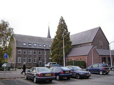
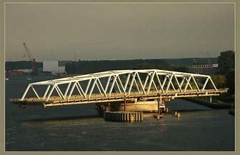
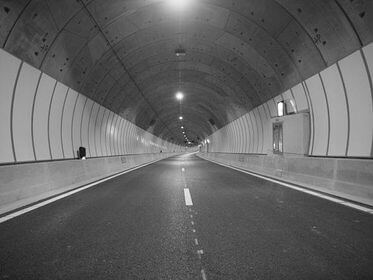
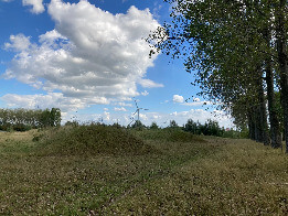
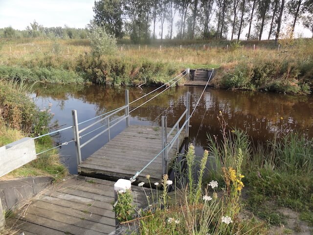
The detour starts at the beginning of the Baljuwlaan, at the statue of the Sluiskil astronaut Lodewijk van de Berg. In 1985 he was the first Dutch person to travel into space and thus wrote history. You will leave behind the village that continued to expand after the construction of the canal in 1825 and the embankment of the Louisapolder in 1844. Cross the roundabout to node 14 and turn left after the freight railway that connects Terneuzen and Ghent. You will pass the Vogel-schordijk and go across farmland, over a narrow church path, to node 35, the Nieuw Vogelschorweg. Via the Visartpolderdijk you arrive at node 34 and follow the Bonteweg, crossing the Lange-weg, towards nodes 93 and 73. You now walk a bit along the busy N61, over the footbridge above the tunnel entrance. Nice to see it from above. In 2015, the tunnel significantly improved accessibility between east and west. As a motorist, you no longer have to wait for the bridge from 1968 - built after the previous one was destroyed in World War II - to close again. For motorists (and still for cyclists) the bridge was a source of annoyance, because it was open an average of 23 times a day. The fact that the walking route partly runs over the tunnel route has been made visible in the landscape. In the meadow grazed by sheep, there are two hundred-meter long embankments parallel to each other. They symbolize the tunnel tubes that pass here 17 meters below ground level and under the canal. This channel, through which ships from all over the world sail, not only brought progress. The village even fell victim to all the changes to the economy: 200 homes were sacrificed, the casino, Vogelbuurt and the 1911 Coke Factory were demolished. For the walker, the changes in the landscape to the west of the canal are beneficial. Suddenly there is a pull raft, the Sleurschuut, with which you cross the western Rijkswaterleiding. It takes a while, but that also has its charm. Walking back over Sluiskilpad you are back in the inhabited, modern world.
POI 1 - Bonte polder.
The Bontepolder is a polder west of Sluiskil, which is part of the Polders in the waterways to Axel and Ghent, in the Dutch province of Zeeland. A permit to reclaim 100 ha of marsh in the eastern part of the Axelse Gat was applied for in 1885. In 1886 the tender for the works followed, including the construction of a 720 m long dam between the Visartpolder and the Pierssenspolder. The polder was completed in 1887. It covers 101 hectares and is named after the Bonte family, who were the main owners.
No additional information.