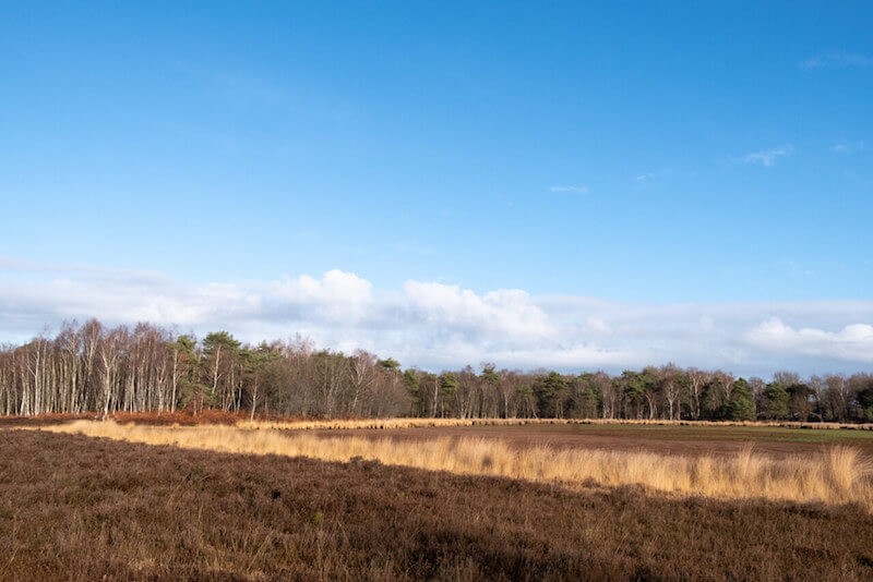
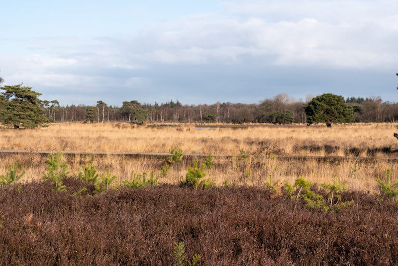
This cross-border hike departs in the Elsakker nature reserve, which owes its name to the former steward Wouter van Elsacker, manager of this area around 1588. Then you walk across the Strijkbeekse Heide, where you can see how the heathland is fully recovered by cutting down coniferous trees and removing the rich humus layer. Along the way you will learn more about the rich smuggling history of this region.
Distance: 8 km.
Time: 2h30.
Grade: Easy.
Type: Circular.
Gps Track: Yes.
Route description: Yes.
Wheelchair: Not suitable.
Dog: Allowed.
Height gain: Flat.
Trail: 95% unpaved.
Marking: Signs "Smokkelpad".
Hiking shoes recommended.
Advertisement.
Walking on smuggling paths.
You leave through the pine forests of the Elsakker, cross the border with the Netherlands at the beautiful river Mark and then walk in the direction of the Zwart Goor in a more open landscape. Then you go over the Strijkbeekse Heide to the Goudberg. When you have just crossed the Mark for the second time you will reach the forgotten border marker 216b. From here it goes back towards the Elsakker through predominantly pine forest.
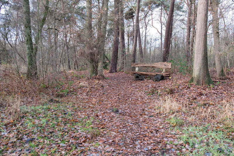
There are several beautiful benches on the route.
Well marked.
POI 1 - Nature Reserves den Elsakker and Strijkbeekse Heide.
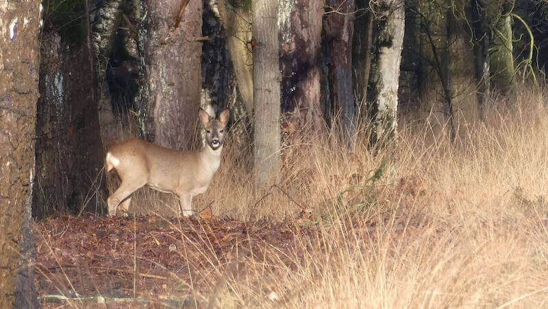
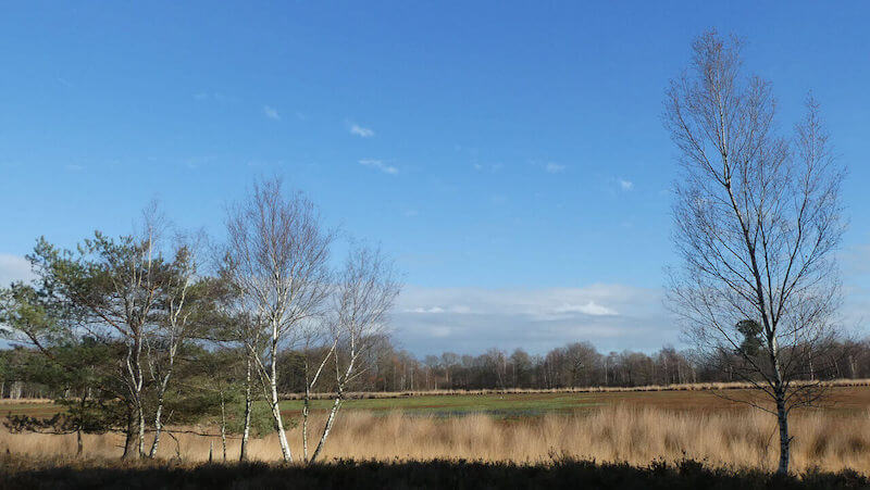
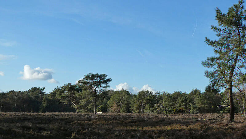
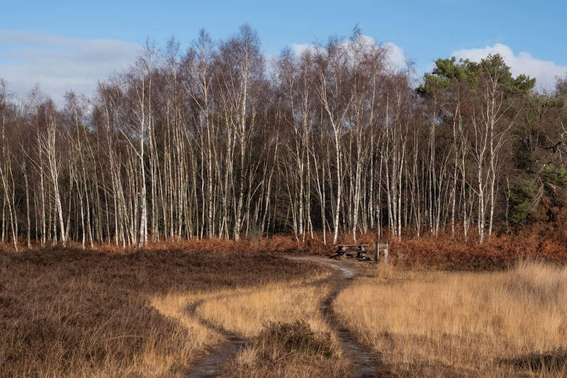
The nature reserve "den Elsakker" owes its name to the former steward Wouter van Elsacker, manager of this area around 1588. After the area has had several owners over the centuries, plans were made around 1960 to parcel the area for construction of homes. However, these plans have not been implemented. In the early 80's the area was purchased by Natuur en Bos. The area is very diverse. In addition to the planted pine trees, you will also encounter heathlands, fens, flowery grasslands and gale stems. Along the Strijbeekse brook, where the terrain conditions are wetter, is mainly elzenbroekbos. The Strijbeekse Heide lies between the Strijbeekse and the Chaamse Beek, near the Belgian border. The area is located on higher sandy soils. Around 1900 the Strijbeek Heide consisted of wet and dry heathland with fens, wetlands and some free-standing conifers. In the first half of the twentieth century, the landscape changed dramatically. Large areas of heath were mined for agriculture and forestry. Forest management played a major role in this forest construction from 1932 onwards. Many ditches were dug for rapid drainage. As a result, coniferous trees could develop better. The wood served, for example, for the propping of mines in South Limburg. Forest management has been carrying out restoration work since 2005. Coniferous trees are cut down and the rich top layer / humus layer is removed. By means of cattle and sheep grazing, the area is kept open and the heather is allowed to recover.
Natuur en Bos:
www.natuurenbos.be
POI 2 - Zwart Goor.
A lot of people where smuggling it that era. This is apparent from the large number of reports, including from the courts were many arrested people were convicted. It was mainly the unemployed who were guilty of smuggling. This is also apparent from the sudden decline of smuggling around the month of October. Many people then found temporary work in the beet campaign. Everything that was cheaper in Belgium was smuggled to the Netherlands; sugar, elastic, tobacco, lamps etc. The items were mostly carried on the bike in bags on the steering wheel, but also hidden in, for example, hollow saddles or under the clothes. Naturally, business from the Netherlands to Belgium was also smuggled. Meat and fish were very popular. Live animals were also transferred to the border. Jute bags around the legs prevent hoof prints. Smuggling was booming in the First World War. There were even trade fairs in Amsterdam and Rotterdam. Smuggling was then not a "penny" earning, it was a big profit at the expense of the Belgians. This was possible thanks to the assistance of the soldiers who were stationed here. Military vehicles were the first cars involved in smuggling.
No extra information.
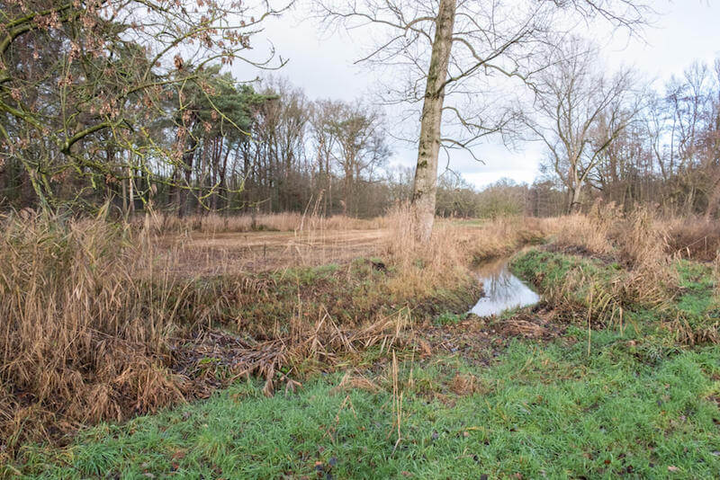
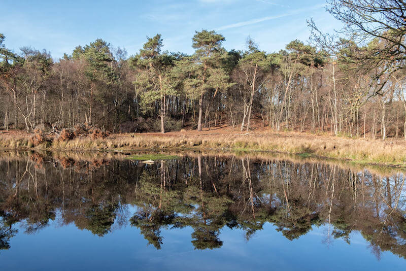
POI 3 - Strijkbeek.
Around 1900, the acreage of heath around the village of Strijbeek was many times greater. Large reclamations for land and forestry were not yet under discussion. An alternation of dry and wet heath, fly pines and fens were defining. The Langven located on the other side of the sandpad where you now can be seen on the old map of 1900. The lake is still largely in the same shape and as it was then. The old border office is also shown on the old card. At this moment Forest Management is working on getting back the original heath landscape. As you can see, a lot of land has been put into use for agriculture and forestry at the moment. Plots with pine forest have been cut down about 5 years ago where you are now. By means of grazing with sheep and cattle we keep these places open, young trees and shrubs do not get a chance to grow big, these are eaten by the animals. Ideal for the heather plant that needs light and space to redevelop. The old border office can still be seen on the Strijbeekseweg.
No extra information.
POI 4 - Goudberg.
From 1870 the boundaries are guarded by customs officers. Six important periods have been distinguished from this period until the 1960s: Salt smuggling, World War I, Crisis years, Second World War, Reconstruction and Butter Time. The last period differs from the previous one due to the more extensive crime. At first it was mainly about easing poverty, now hard money had to be earned. There were armed gangs who transported many hundreds of kilos of butter with armored cars at the same time. Many people were killed and injured, especially on the customs side. In addition to crow's feet, oil and smoke bombs, they even used flame throwers and aircraft engines to shake pursuers. European agricultural policy put an end to butter trafficking. There is a suspicion that the butter smugglers have started to engage in the illegal firing of alcohol.
No extra information.
POI 5 - Border post 216b.
You are here on the border between the Netherlands and Belgium. In the grass along the side of the road you still have an old border post. During the construction of the 'smuggling path', a boundary marker was found that had been 'disappeared' for years. It is a bluestone border post with no 216b. The boundary post had completely disappeared because it had sunk into the ground over the years, with its weight of more than 600 kg. The place where the bluestone border is standing is marshy ground and has sank further and further over the years. In addition, the boundary post was buried under clearance spoil. At the beginning of 2012 the boundary marker was placed back to its original height, being about 75 cm above the ground level. The total height of this stone is 125 cm with a pedestal of 50 cm x 50 cm and above it a trapezoidal body of 75 cm height. This trapezoidal body is the part that normally protrudes above the ground level. Boundary stone 216b is a bluestone intermediate boundary which was placed there in the years 1843/1844. The main road posts are made of cast iron. The Proces Verbal for the placement as well as the tendering of the boundary posts on the national border between Belgium and the Netherlands dates back to 1843. In the same year and the following year, the border posts were placed on the national border. It involved 388 cast iron main poles and 356 bluestone intermediate poles. Working method for dealing with border posts: In principle, boundary posts are checked every year for their presence and physical condition, but in recent years this only happens for cast iron main posts. The audit is carried out by and with representatives of the neighboring municipalities. From these annual inspections PVs are drawn up that go to the provincial governments of both countries, including the municipalities. If there are deviations or repairs must be carried out, this will be examined by the permanent border committee. Representatives from both countries are represented in this committee.
No extra information.
POI 6 - Sand bees.
Here you will find an artificial nesting place for bees. Wild bees are bees that, unlike honey bees, are not kept by humans. A minority of wild bees live socially. The nest then consists of a queen with workers. An example of this are the bumblebees. Most species, however, have a solitary way of life in which each female makes a separate nest. These separate litters can occur in a colony context. Very striking are the (large) colonies of gray sand bees that appear early in the year on sandy soil near willows. The males and females of wild bees often differ greatly in size and color. In our country there are about 350 different species of wild bees. All these species make different demands on their living environment. Wild bees can be encountered from early in the spring, when they forage on crocuses and willow catkins, until late in the autumn. Most species are usually only seen a few weeks per year. All species make different demands on their living environment, but two things they certainly need to reproduce: flowers and suitable nesting sites. Wild bees need flowers for various reasons. The bees themselves drink nectar that they use as food. The females collect pollen through special collection devices on the hind legs or belly. In the breeding cells of her nest, the female supplies a supply of pollen. She puts an egg on it and then she closes the brood cell. The larva that comes from the egg eats the pollen. The larva then pupates and a new bee appears, often not until the following year. So without flowers there are no new bees. Many species nest in the ground. They need bare soil for that. On the sand paths in the Elsakker you can encounter the gray sand bee in the spring and the feather foot in the summer. Other species make their nest in corridors in wood or in hollow stems. A number of species do not make a nest themselves. The females of those bees lay their eggs in the nest of other bees, just like a cuckoo does. We call this brood parasites, or cuckoo bees. Wild bees are the most important pollinators in nature and in the garden. They are also important for agriculture and horticulture. However, many wild bee species are threatened by impoverishment of the plant world, eutrophication and the disappearance of small landscape elements. We can help the bees, by putting suitable flowers in the garden and by offering nesting facilities. We can help bees that nestle in small corridors in wood or hollow stems. Drill holes in wood blocks or stone with different diameters and hang them in the garden. You can also help them by hanging bunches of bamboo or cane stalks. Often in the first year, hallways are used by bees. Or through bushes of bamboo or cane stalks.
No extra information.
POI 7 - Chapel.
Here you can see the Sacred Heart Chapel in the Elsakker and a memorial stone in the chapel. This reminds one of the marriage between Lauwers and Dupret in 1920. The domain forest Elsakker originated in the 16th century when it was part of the property of the Stift van Thorn (a convent community in Dutch Limburg). The first steward of the area was the Wouter van Elsakker, who was buried in the church of Meerle after his death in 1588. After the French invasion of 1794, the formal abolition in 1797 put an end to the abbey and the Principality of Thorn. Thorn was first annexed by France and after the Vienna Congress it became a municipality in the Kingdom of the Netherlands. The Elsakker domain came into the hands of Mr. Jan Petrus Eeltjens from Breda. He stayed in the villa along the Chaamseweg until his death in 1860. In inheritance the domain was transferred to the Dupret-Bruggeman family from Brussels. After the death of Mrs. Dupret in 1899, the property was divided. Elsakkerbos and the villa along the Chaamseweg fell into the part of Mr. William Lauwers-Jeanne Dupret. In 1904 Lauwers rebuilt the villa. At the older generation of Meerle still speaks about the villa and the good of Lauwers.
No extra information.