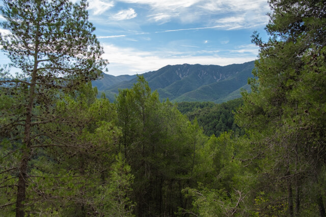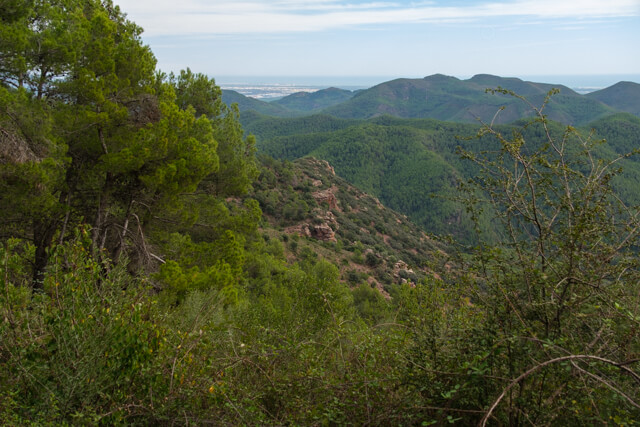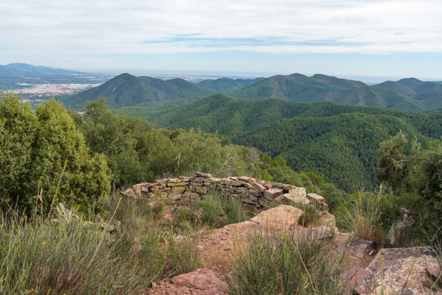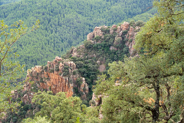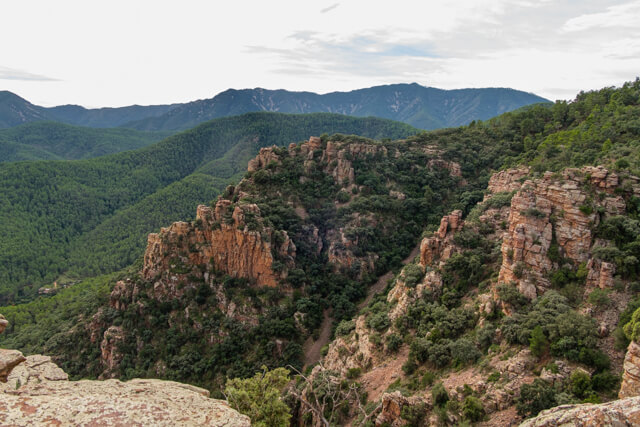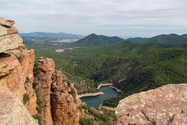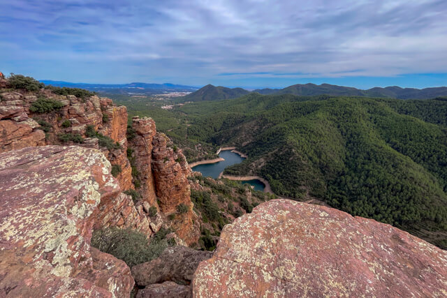
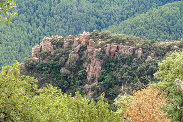
Walk through a beautiful gorge with overwhelming vegetation and over the ridges of Pic Cassalet and Las Peñas de Gil to the Pico de los Organos. From the Pico it continues to the famous viewpoint Organos de Benitandus, which means 'organ pipes of Benitandus'. Here you have two viewpoints, which give you a great panorama of these rocks sculpted by erosion, the Onda reservoir and even the Mediterranean Sea.
Distance: 11 km.
Time: 4h30.
Grade: Moderate.
Type: Circular.
Gps Track: Yes.
Route description: No.
Wheelchair: Not suitable.
Dog: Allowed.
Height gain: 508 meters.
Trail: 95% unpaved.
Marking: None.
Hiking shoes recommended.
Advertisement.
Organos de Benitandus.
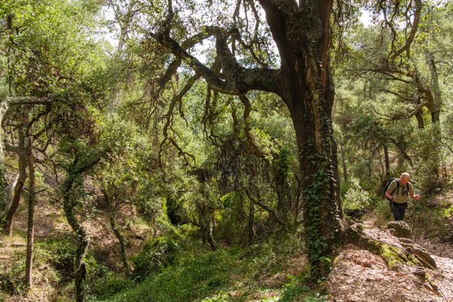
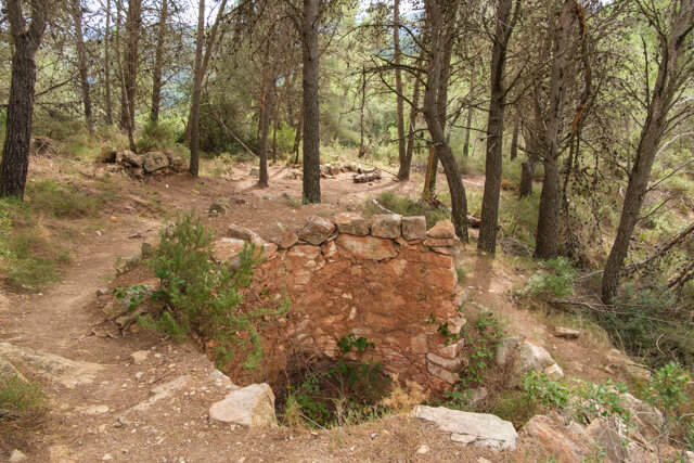
The route departs on a quiet path to the Fuente de San Pedro, where the path begins to ascend slightly and we follow the GR36 for a while. Then we leave the GR36 and enter a ravine with lush vegetation. Once we leave the ravine we continue over the ridges of the Pic Cassalet and Las Peñas de Gil. We pass an old lime kiln and the ruins of Corrales. The path continues along the ridge, leaving El Cassalet on the left, until the Pico de los Organos. Finally we arrive at the Organos de Benitandus. The first viewpoint requires some climbing on a rock, but the view is truly fantastic. A little further on comes the second viewpoint from which you have a view of the Onda reservoir and even the Mediterranean Sea in clear weather. Here you can also clearly see why the eroded rocks are called organ pipes. After a steep descent we arrive in the hamlet of Benitandus. From here the Veo valley is followed to the starting point.
Download PDf for map.
The Veo valley is followed from the hamlet of Benitandus to the starting point, but some sense of orientation is required here. The boring main road CV223 directly to Alcudia de Veo is a possible alternative.