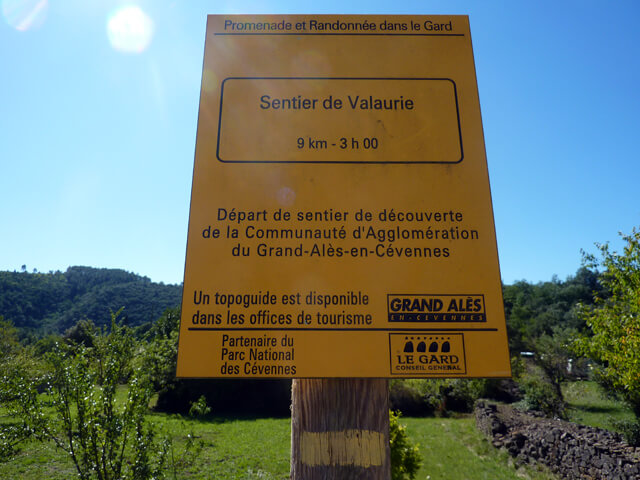
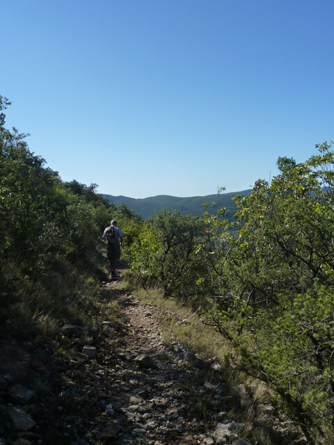
This varied walk takes you past the caves of Valaurie through a wooded and shady area. Once you have crossed the Col de Valaurie, you will mainly get beautiful views of the Gardon de Saint-Jean and Mialet valleys.
Distance: 9 km.
Time: 3h00.
Grade: Easy.
Type: Circular.
Gps Track: Yes.
Route description: Yes.
Wheelchair: Not suitable.
Dog: Allowed.
Height gain: 253 meters.
Trail: 98% unpaved.
Marking: PR - Yellow dash.
Hiking shoes recommended.
Advertisement.
The Gardon de Saint-Jean valley.
From the starting point you first walk on a paved road through the hamlet of Le Village in the direction of a stream. You cross the stream and begin the climb to the caves of Valaurie. Unfortunately, according to our information, these are no longer accessible to the public. From the caves you continue to the Col de Vallaurie. From the Col you climb further to a beautiful viewpoint. During the descent you have a beautiful view of the valleys of the Gardon and Salendringue. You come back at the intersection of the outward road and follow the paved road again to the starting point.
Download PDF for route description.
The caves of Valaurie are closed to the public.