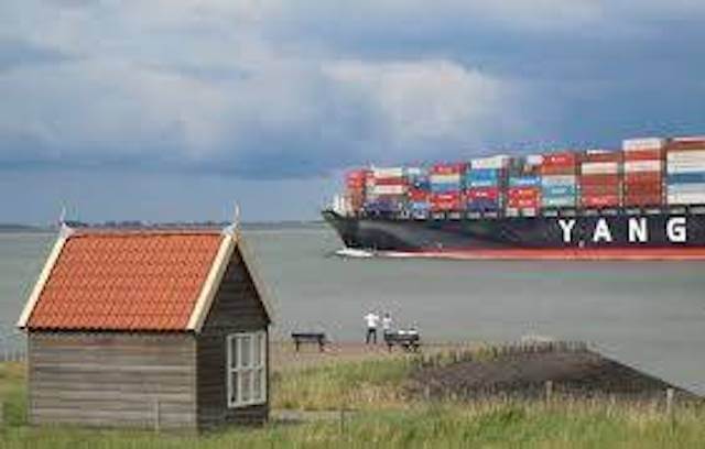
The walk starts at the nameless windmill and passes St. Martin's Church. It continues on polder roads in the direction of the Western Scheldt, where you can see the largest sea-going vessels passing by. You return to the starting point through the walking area of Hof ter Zandeplein.
Distance: 12.6 km.
Time: 3h00.
Grade: Moderate.
Type: Circular.
Gps Track: Yes.
Route description: Yes.
Wheelchair: Not suitable.
Dog: Allowed.
Height gain: Flat.
Trail: Mainly paved.
Marking: Walking nodes.
Hiking shoes recommended.
Advertisement.
Klaphuisje.
You enter the Groenendijk at the windmill. On polder roads through the hamlet of Noordstraat you reach the old mooring place of the ferry in Perkpolder. The route continues through a grassy landscape with a wide view of the area with various views of the Western Scheldt. After passing the old village of Walsoorden you will arrive at the Westerscheldedijk with the old harbor. Here is also a so-called 'klaphuisje' (chat house) where you will be able to see the largest sea-going vessels pass by a stone's throw during a break. Via the Hof ter Zandeplein and along the edge of Kloosterzande towards Poolsplein.
Download PDf for route description.
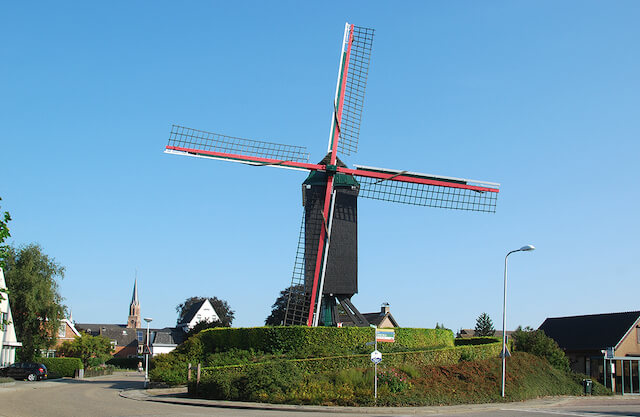
POI 1 - Kloosterzande windmill.
Kloosterzande mill is the name of the unnamed standerd mill in Kloosterzande in the Dutch province of Zeeland. The mill was probably built around 1690 near Kuitaart as an oil mill and rebuilt around 1781 in Kloosterzande as a flour mill. In 1959 the mill became the property of the then municipality of Hontenisse. The mill is currently owned by the municipality of Hulst. After restoration in 1995, the mill is regularly put into operation by a volunteer miller.
No additional information.
POI 2 - Burghpolder.
The Burghpolder is a polder to the west of Kloosterzande, which is part of the Polders of Hontenisse and Ossenisse. The polder was diked around 1210 as a Zoutelantpolder by the monks of the Ten Duinen Abbey, but it was flooded during the inundations of 1585 and was redijked in 1610. Then it got the name: Burg- en Zoutelandspolder, later this became: Burghpolder.
No additional information.
POI 3 - Noordhofpolder.
Around 1200, the polder was constructed as Besloten Noortpolder, later it was called Noordhofpolder, after an outhof that the monks of the Ten Duinen Abbey erected here, next to the already existing Hof te Zande. A farm of that name still exists.
No additional information.
POI 4 - Noorddijkpolder.
This polder probably once had a larger size and was embanked by the monks of the Ten Duinen Abbey in the early 13th century. However, probably shortly after 1575, it was inundated and rebuilt to a smaller size in 1622.
No additional information.
POI 5 - Zandpolder.
The Zandpolder is the oldest polder in this complex. It has existed since 1170 and measures 259 ha. It was diked by the monks of the Ten Duinen Abbey, who founded an uithof, Hof te Zande, in this polder. To the north of this, the village of Kloosterzande was created and on the western dike, Groenendijk grew from 1692.
No additional information.
POI 6 - Hof te Zande.
Hof te Zande was a courtyard of the Cistercian Abbey Ten Duinen, located near what is now Kloosterzande. After the Ten Duinen Abbey had acquired the right of ownership of the salt marshes in the wider area in 1196, the monks began to reclaim the area. This resulted in the polder complex: Polders of Hontenisse and Ossenisse.
No additional information.