Select your language

-
Along the flanks of the Sierra del Penyal
The walk goes from Benimaurell along the flanks of the Sierra del Penyal almost to the Penya Roja, also called Cavall Verd. Along the way you can enjoy beautiful views to the Aitana and on the other side of La Vall d'Ebo and Barranc de l'infern, among others.
-
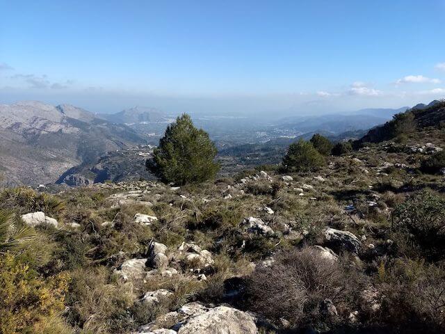
Around Lliber
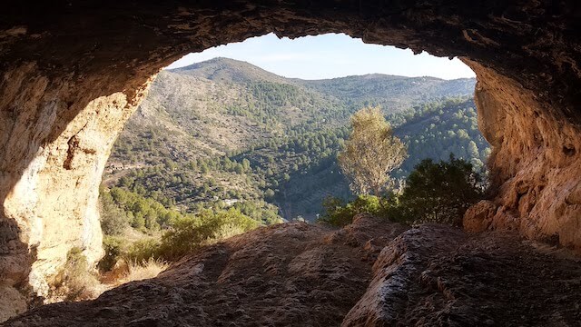
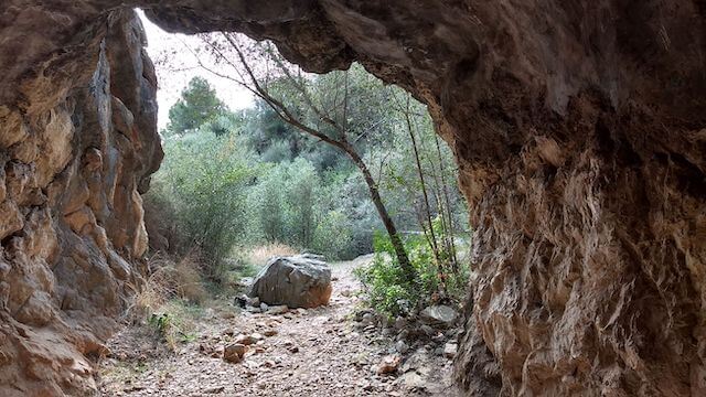
This walk goes from Senija to the Cova de La Garguantua, the hideout of the famous bandit Josep de la Tona. From the cave it continues to the Creu de Senija, with a beautiful panoramic view and around Lliber back to Seija.
-
Around Tàrbena
This walk first goes to the Barranc Tancat viewpoint from where you have a beautiful view of the gorge and the Sierra de Mariola and then goes through the valley around Tàrbena with the final eye-catcher being the Mirador de Tàrbena viewpoint.
-
Castell d'Aixa

This walk starts in Jalon and goes uphill to the ruins of Castell d'Aixa. Then you descend to Lliber to walk along the Riu Gorgos, a part of GR 330, back to Jalon.
-
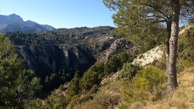
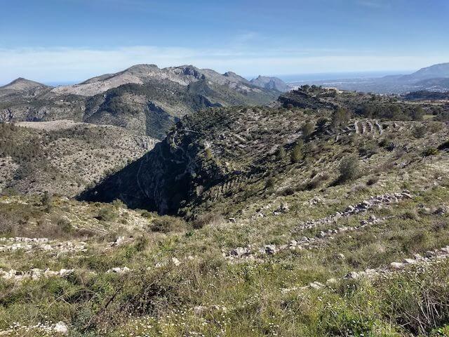
Els Arcs de Castells
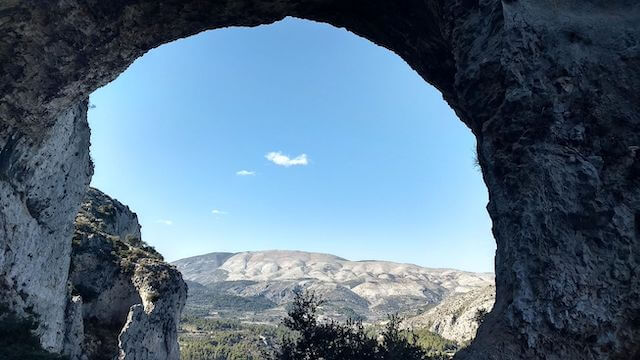
This walk goes to Els Arcs de Castells, an impressive geological rock formation that forms large arches on the north side of the Sierra de la Xortà. This arch formation offers beautiful views all around and in the distance you can see the border where a large forest fire raged in 2022.
-
La Presa de Isbert
This walk goes from Fontilles, via a 100 meter long tunnel to the useless dam, La Presa de Isbert. Then we walk along the barranc de l'infern towards Ebro. We return to our starting point via the riverbed of the barranc de Fontilles and the leper center of Fontilles.
-
Pantano de Relleu Route
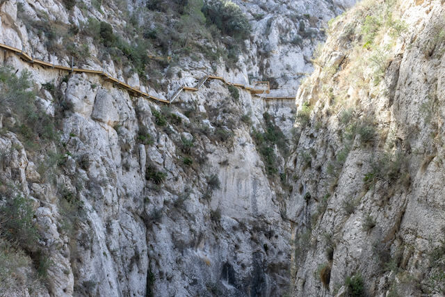
Walk to the seventeenth-century dam of the Relleu reservoir with a beautifully landscaped walkway through the gorge and along the old mule path Cami de les Ripalmes or Cami de Fasamais that has been brought back from oblivion.
-
Paseo Ecológico

Walking route along the coastline from Calpe to Benissa via a beautifully landscaped path with various information panels about the flora and fauna along the way.
-
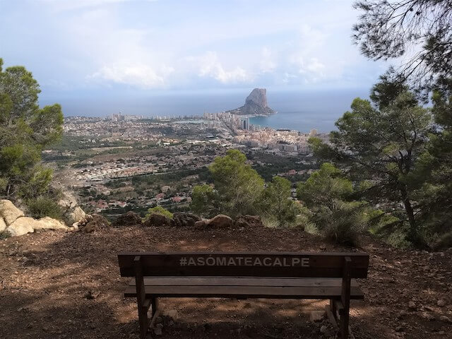
Peñón de Ifach
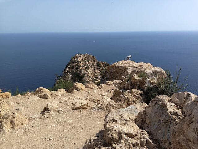
The Peñón de Ifach is the symbol of the Costa Blanca. This limestone rock is 332 meters high and one kilometer long. The rock is connected to the land by a narrow isthmus, the result of a landslide from the nearby Sierra de Oltà. At the top you have beautiful views over the impressive coastline of the Costa Blanca. You can see for miles, as far as Moraira and on clear days you can even see Ibiza from the top of the Ifach.
-
Penya Foradà
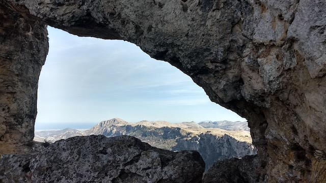
This walking route goes to the Penya Foradà or Foradada at an altitude of 737 meters above sea level, a true natural wonder in the province of Alicante. From this stone arch you have a beautiful view of a large part of La Vall de Gallinera.
-
The bay of Cala Llebeig
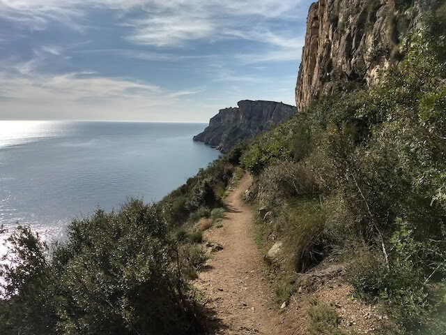
The walk goes from Moraira via the Barranco de La Viuda to the bay of Cala Llebeig. From the bay you continue on the coastal path along the cliffs to the Cova dels Arcs and Cala Moraig.
-
The Moorish Steps in Benimaurell
This walk runs just above Benimaurell and lets you taste part of the famous “Catedral de Senderismo” (with its 6800 Moorish steps) and crosses the Barranc de l'Infern.
-
To the summit of the Olta
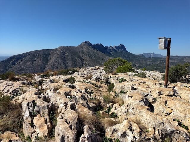
This walk goes from Calpe to the top of the Olta at an altitude of 585 meters via 2 Sendas Tradicionales or traditional hiking trails. At the top you have a beautiful view of the various mountain peaks in the area: such as Puig Campana, the Bernia and the Montgo.
-
Vuelta d'Olta
This walk through the hills of the Sierra de Oltà goes around the Olta, a mountain near Calpe. Along the way you have beautiful views of the Puig Campana, the impressive Bernia, the Montgo and the famous Peñón de Ifach.