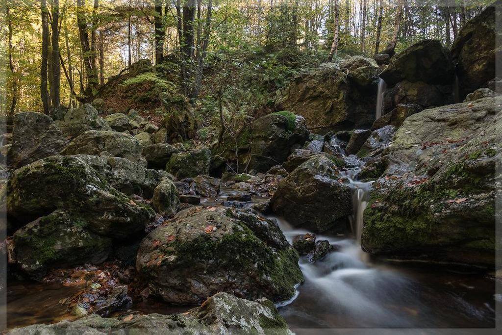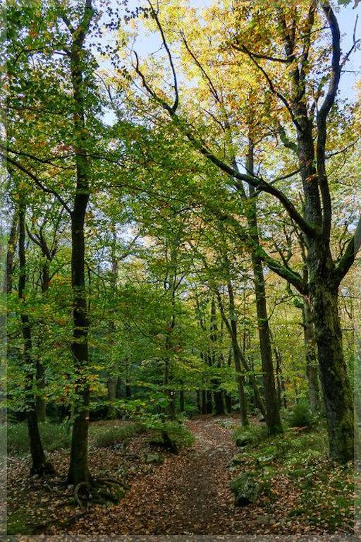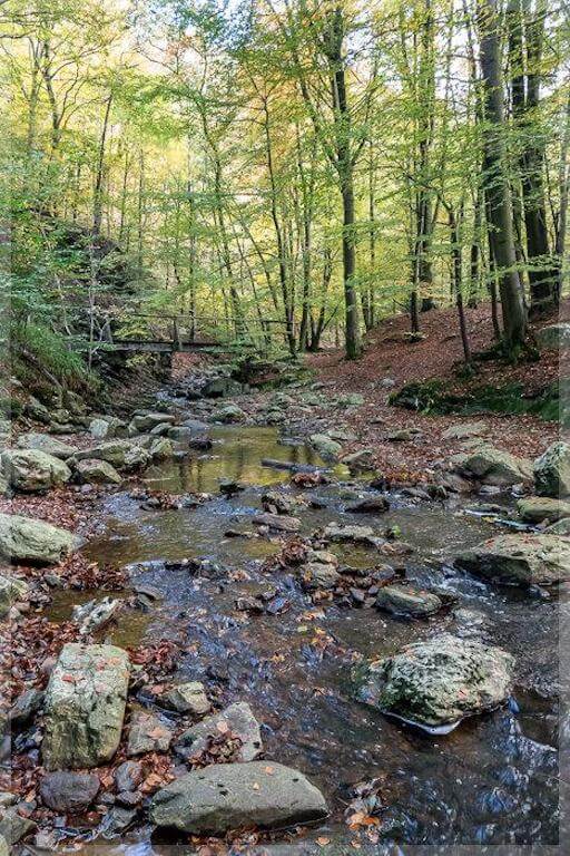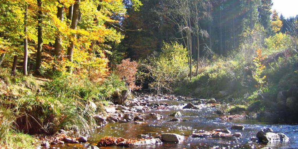
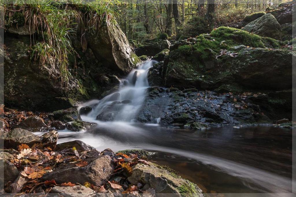
In the beginning of the walk, attention is drawn to beautiful old farms and their thick walls that are typical of this region with a rough climate. After a few minutes you reach the Statte, a pristine little river. The trail leads over numerous small bridges and stone paths to the 'Rocher de Bilisse', a nearly 50 meters high rock wall in the middle of the forest. The slightly further waterfall 'Cascade des Nûtons' is especially impressive after heavy rains.
Distance: 9 km.
Time: 3h00.
Grade: Easy.
Type: Circular.
Gps Track: Yes.
Route description: Yes.
Wheelchair: Not suitable.
Dog: Allowed.
Height gain: 257 meters.
Trail: Mainly unpaved.
Marking: blue rectangle.
Hiking shoes recommended.
Advertisement.
Cascade des Nûtons.
Further on the road leads to a field with rocks from the last ice age and the dolmen of Solwaster. The dolmen gave rise to numerous speculations. Shortly afterwards you come out of the semi-darkness of the forest and the ravines in the light of the heights of Solwaster. Afterwards you look out over the fields and the hedges of the village and come back to the starting point.
Download PDf for route description.
In wet weather or snowfall you have to be careful on the bridges, the rocks and the steep parts of the course.
POI 1 - The Valley of the Statte.
The river Statte rises in the bog area of Wihonfagne on the High Fens at 580m altitude. The "Rock of Bilisse", is a perpendicular rock of almost 50m high. The fracture visible in the rock is the result of upward movements and folds in the earth's crust, which have taken place in the geological past of this area. In the valley of the Statte you can find remains of the once immense beech and oak forests. The banks of the Statte are rich in mosses and ferns. More upstream, after the famous waterfall of the trolls ("Cascade des Nutons"), pine forest has been planted, especially on deposits with many angular stones ("pierrier"). These deposits were formed at the end of the last ice age, about 15,000 years ago, by the flow of the water-saturated thaw layer. The dolmen, a huge "table" of sandstone measuring 3m by 2m and having a weight of 17 tons, was discovered in 1887 and has made the historians perplexed about its authenticity. Is it a dolmen dating back to Celtic times? Current historians and specialists have determined that this is a megalith, caused by natural processes during the periglacial climate. Traces of ancient civilizations, however, were abundant in the region.
Office du Tourisme de Jalhay-Sart.
www.tourismejalhaysart.be.